Welcome to Classical Images!
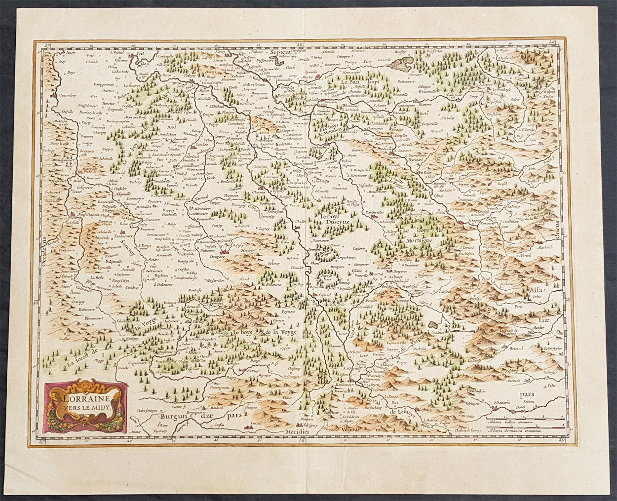
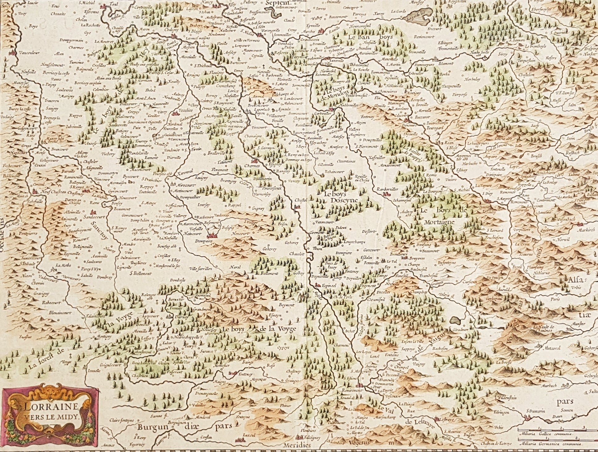
Description:This beautifully hand coloured original antique map of the ancient Lorraine region of France - centering on the Moselle River with the city of Nancy to the north Faucogney-et-la-Mer to the south & the Meuse River to the west - by Gerard Mercator was published by Jodocus Hondius in the 1638 edition of Mercators Atlas.
General Definitions:Paper thickness and quality: - Heavy and stablePaper color : - off whiteAge of map color: - OriginalColors used: - Yellow, green, blue, pinkGeneral color appearance: - AuthenticPaper size: - 21 1/2in x 17 1/2in (545mm x 445mm)Plate size: - 19 1/2in x 15 1/2in (500mm x 395mm)Margins: - Min 1/2in (12mm)
Imperfections:Margins: - Light age toningPlate area: - NoneVerso: - Light age toning
Background: Lorraine is a cultural and historical region in north-eastern France, now located in the administrative region of Grand Est. Lorraines name stems from the medieval kingdom of Lotharingia, which in turn was named for either Emperor Lothair I or King Lothair II. It later was ruled as the Duchy of Lorraine before the Kingdom of France annexed it in 1766.