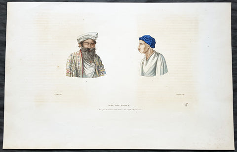
Welcome to Classical Images!
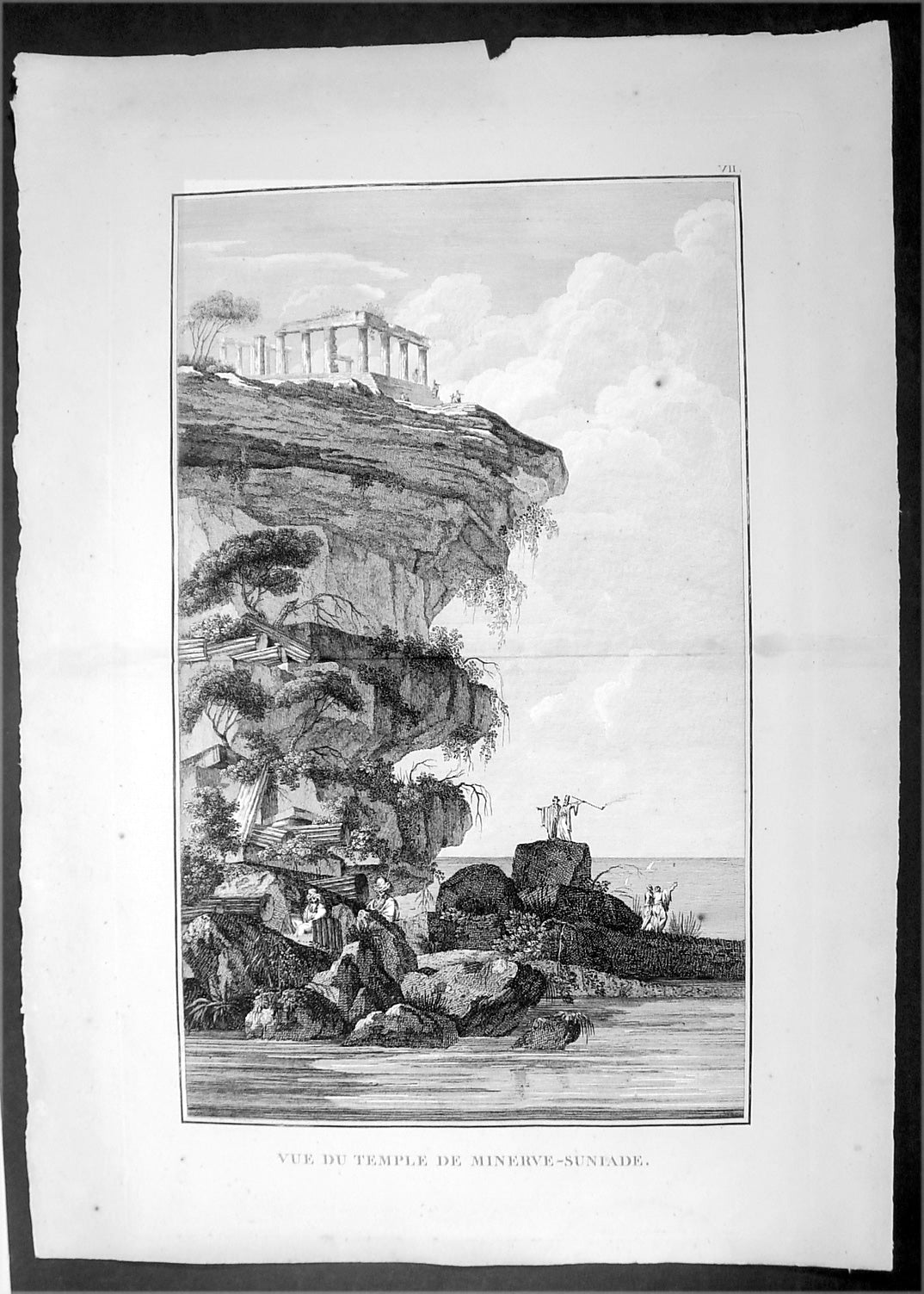
Description:This original copper-plate engraved antique print view of the ruins of the Temple of Poseidon, on the cliffs on Cape Sounion, Attica Peninsula, Greece, south of Athens was published in the 1802 edition of Jean-Baptiste Lechevaliers of Voyage de la Troade, fait dans les années 1785 et 1786
General Definitions:Paper thickness and quality: - Heavy and stablePaper color : - off whiteAge of map color: - Colors used: - General color appearance: - Paper size: - 20in x 14in (510mm x 360mm)Plate size: - 17 1/2in x 11in (445mm x 280mm) Margins: - Min 1/2in (12mm)
Imperfections:Margins: - NonePlate area: - NoneVerso: - None
Background: Cape Sounion is the promontory at the southernmost tip of the Attic peninsula, 8 kilometres south of the town of Lavrio (ancient Thoricus), and 70 kilometres southeast of Athens. It is part of Lavreotiki municipality, East Attica, Greece.Cape Sounion is noted for its Temple of Poseidon, one of the major monuments of the Golden Age of Athens. Its remains are perched on the headland, surrounded on three sides by the sea.The original, Archaic-period temple of Poseidon on the site was built of tufa. The Sounion Kouros, discovered in 1906 in a pit east of the temple alongside fragments of other statues, was probably one of a number of votive statues dedicated to Poseidon which probably stood in front of the gods sanctuary. The archaic temple was probably destroyed in 480 BC by Persian troops during Xerxes I\'s invasion of Greece. After they defeated Xerxes in the naval Battle of Salamis, the Athenians placed an entire captured enemy trireme (warship with three banks of oars) at Sounion as a trophy dedicated to Poseidon.The temple of Poseidon at Sounion was constructed in 444–440 BC. This was during the ascendancy of the Athenian statesman Pericles, who also rebuilt the Parthenon in Athens. It was built on the ruins of a temple dating from the Archaic period. It is perched above the sea at a height of almost 60 metres. The design of the temple is a typical hexastyle, i.e., it had a front portico with six columns. Only some columns of the Sounion temple stand today, but when intact it would have closely resembled the contemporary and well-preserved Temple of Hephaestus beneath the Acropolis, which may have been designed by the same architect.As with all Greek temples, the Poseidon building was rectangular, with a colonnade on all four sides. The total number of original columns was 36: 15 columns still stand today. The columns are of the Doric Order. They were made of locally quarried white marble. They were 6.10 m high, with a diameter of 1 m (3.1 ft) at the base and 79 cm at the top. At the center of the temple, colonnade would have been the hall of worship (naos), a windowless rectangular room, similar to the partly intact hall at the Temple of Hephaestus. It would have contained, at one end facing the entrance, the cult image, a colossal, ceiling-height (6 metres (20 ft)) bronze statue of Poseidon.Jean-Baptiste Lechevalier was the secretary of the Ambassador of France in Constantinople. In the year 1788 he visited the plain of Troy, and was enthusiastically in favour of the theory that the site of Homers Troy was to be found at the village of Bunarbashi. His publication about Troy Voyage de la Troade.....was first published in 1799.The Troad, also known as Troas, is the historical name of the Biga peninsula (Biga Yarımadası, Τρωάς) in the northwestern part of Anatolia, Turkey. This region now is part of the Çanakkale province of Turkey. Bounded by the Dardanelles to the northwest, by the Aegean Sea to the west and separated from the rest of Anatolia by the massif that forms Mount Ida, the Troad is drained by two main rivers, the Scamander (Karamenderes) and the Simois, which join at the area containing the ruins of Troy. Grenikos, Kebren, Simoeis, Rhesos, Rhodios, Heptaporos and Aisepos were seven rivers of the Troad and the names of the river gods that inhabited each river.Troy (Ancient Greek: Τροία, Troia or Τροίας, Troias, Truva or Troya) was a city in the far northwest of the region known in late Classical antiquity as Asia Minor, now known as Anatolia in modern Turkey, just south of the southwest mouth of the Dardanelles strait and northwest of Mount Ida. The present-day location is known as Hisarlik. It was the setting of the Trojan War described in the Greek Epic Cycle, in particular in the Iliad, one of the two epic poems attributed to Homer. Metrical evidence from the Iliad and the Odyssey suggests that the name λιον (Ilion) formerly began with a digamma: Ϝίλιον (Wilion); this is also supported by the Hittite name for what is thought to be the same city, Wilusa.A new capital called Ilium (from Greek: λιον, Ilion) was founded on the site in the reign of the Roman Emperor Augustus. It flourished until the establishment of Constantinople, became a bishopric and declined gradually in the Byzantine era, but is now a Latin Catholic titular see.In 1865, English archaeologist Frank Calvert excavated trial trenches in a field he had bought from a local farmer at Hisarlik, and in 1868, Heinrich Schliemann, a wealthy German businessman and archaeologist, also began excavating in the area after a chance meeting with Calvert in Çanakkale. These excavations revealed several cities built in succession. Schliemann was at first skeptical about the identification of Hisarlik with Troy, but was persuaded by Calvert and took over Calverts excavations on the eastern half of the Hisarlik site, which was on Calvert\'s property. Troy VII has been identified with the city called Wilusa by the Hittites (the probable origin of the Greek λιον) and is generally (but not conclusively) identified with Homeric Troy.Today, the hill at Hisarlik has given its name to a small village near the ruins, which supports the tourist trade visiting the Troia archaeological site. It lies within the province of Çanakkale, some 30 km south-west of the provincial capital, also called Çanakkale. The nearest village is Tevfikiye. The map here shows the adapted Scamander estuary with Ilium a little way inland across the Homeric plain. Due to Troys location near the Aegean Sea, the Sea of Marmara, and the Black Sea, it was a central hub for the military and trade(Ref: M&B; Tooley)