British Isles (89)
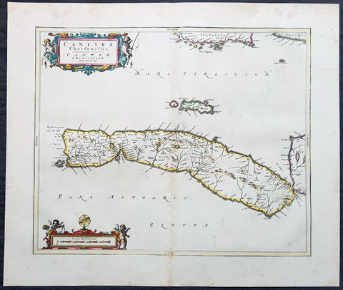
1657 Joan Blaeu Antique Map of Kintyre Peninsula Western Scotland, Argyll & Bute
- Title : Cantyra Chersonesus - Cantyr a Demie-yland..
- Ref #: 50384
- Size: 24in x 20 1/2in (610mm x 520mm)
- Date : 1657
- Condition: (A+) Fine Condition
Description:
This beautifully engraved hand coloured original antique map of the Kintyre Peninsula, located in the southwest of Argyll and Bute, Western Scotland was published in the 1657 Spanish edition of Joan Blaeu\'s Atlas Novus after the the famous Scottish Cartographer Timothy Pont (1524-1606)
When Blaeu published Volume five of his 1654 Atlas Novus of Scotland, became one of the best-mapped countries in the world. The volume contained forty-eight plates showing forty-nine separate maps of Scotland (plus a map of Ptolemy British Isles and six maps of Ireland). The first two plates from the atlas show the entire country ancient and modern, whilst the remaining forty-six plates cover most of Scotland in forty-seven regional maps. In total the regional maps locate some 20,000 different place names. A clue as to the reason for this extraordinary explosion of geographical information is to be found on thirty-six of the regional maps, which all carry engraved credits to Timothy Pont (1524-1606)
Pont was responsible for surveying the greater part of Scotland between 1583-1600, the resulting Pont Manuscript maps were never published but were put to good use some fifty to seventy years later by Robert Gordon and Joan Blaeu. (Ref: Koeman; Tooley; M&B)
General Definitions:
Paper thickness and quality: - Heavy and stable
Paper color : - off white
Age of map color: - Original
Colors used: - Blue, pink, red, green, yellow
General color appearance: - Authentic
Paper size: - 24in x 20 1/2in (610mm x 520mm)
Plate size: - 20in x 16 1/2in (510mm x 420mm)
Margins: - Min 1in (25mm)
Imperfections:
Margins: - Light age toning
Plate area: - Very light soiling
Verso: - Light showthrough
Background:
Kintyre is a peninsula in western Scotland, in the southwest of Argyll and Bute. The peninsula stretches about 30 miles, from the Mull of Kintyre in the south to East Loch Tarbert in the north. The area immediately north of Kintyre is known as Knapdale.
In 1293, king John Balliol established shrieval authority by creating the post of sheriff of Kintyre. Shortly after, Robert de Bruys launched a civil war challenging John for the throne. By this point, Somerleds descendants had formed into three families - the MacRory, the MacDougalls, and the MacDonalds; the MacDougalls took John\'s side, while the MacDonalds and MacRory backed de Bruys. When de Bruys defeated John, he declared the MacDougall lands forfeit, and gave them to the MacDonalds.
The head of the MacDonald family married the heir of the MacRory family, thereby acquiring the remaining share of Somerleds realm, and transforming it into the Lordship of the Isles, which lasted for over a century. After 4 years and 3 children, however, he divorced Amy, and married Margaret, the daughter of Robert II, the Scottish king, who gave him the remaining parts of Kintyre, along with the whole of Knapdale, as a dowry.
In 1462, however, John, the then Lord of the Isles, plotted with the English king to conquer Scotland; civil war in England delayed the discovery of this for a decade. Upon the discovery, in 1475, there was a call for forfeiture, but a year John calmed the matter, by quitclaiming Ross (Easter, Wester, and Skye), Kintyre, and Knapdale, to Scotland.
At an unclear point before 1481, the sheriffdom of Kintyre became Tarbertshire, based at Tarbert at the northern edge of Kintyre; in that year, Tarbertshire was expanded to include Knapdale. However, comital authority remained absent following the quitclaim from the Lord of the Isles; following a law and order crisis in the region, king James IV of Scotland appointed Archibald Campbell, the Earl of Argyll as governor of Tarbert Castle, with implied authority over nearby castles such as Skipness.
Following the Scottish reformation, the MacDonalds (opponents) and Campbells (supporters) came into more direct dispute. In 1607, Following a series of hostile actions from the MacDonalds, King James VI ordered the lands they landlorded in Kintyre to be transferred to the Archibald Campbell, heir of the earlier Archibald. Under pressure from the Campbells, the sheriff court moved to Inveraray at the extreme northeast of Tarbertshire, near the heart of Campbell power; somewhat inevitably, in 1633 shrieval authority was annexed by the sheriff of Argyll.
Archibalds son, a dedicated supporter of the religious reformers, developed a plan to establish a large settlement, around the village of Kinlochkilkerran, at the south of Kintyre, composed of loyal Presbyterians from Lowland Scotland, in order to outnumber and undermine the local Catholic population, and reduce resistance to the states religious reforms. Under his son, Archibald, this became Campbeltown. Their actions also had the effect of diluting Gaelic culture, gradually replacing it with a lowlands one.
Comital powers were abolished by the Heritable Jurisdictions Act, leaving only the shrieval unit. In 1899, counties were formally created, on shrieval boundaries, by a Scottish Local Government Act; Kintyre therefore became part of the County of Argyll. Following late 20th century reforms, it is now within the wider region of Argyll and Bute.
Timothy Pont (c. 1565–1614) was a Scottish cartographer and topographer, the first to produce a detailed map of Scotland. Ponts maps are among the earliest surviving to show a European country in minute detail, from an actual survey.
He was the elder son of Robert Pont, a Presbyterian cleric and politician, by his first wife, Catherine, daughter of Masterton of Grange. He matriculated as student of St. Leonard\'s College, St. Andrews, in 1580, and obtained the degree of M.A. of St Andrews University in 1584. He spent the late 1580s and the 1590s travelling throughout Scotland, mapping the country. Between 1601 and 1610 he was the minister of Dunnet Parish Church in Caithness. He was continued 7 December 1610; but he resigned some time before 1614, when the name of William Smith appears as minister of the parish. On 25 July 1609 Pont was enrolled for a share of two thousand acres (8 km²) in connection with the scheme for the plantation of Ulster, the price being 400l.
Pont was an accomplished mathematician, and the first projector of a Scottish atlas. In connection with the project he made a complete survey of all the shires and islands of the kingdom, visiting remote districts, and making drawings on the spot. A contemporary described how Pont personally surveyed...and added such cursory observations on the monuments of antiquity...as were proper for the furnishing out of future descriptions. He died having almost completed his task.
The originals of his maps, which are preserved in the National Library of Scotland, Edinburgh, are characterised by neatness and accuracy. Ponts manuscript maps are key historical documents for their time, of importance in the fields of place-names, settlements, and other studies. Many of the maps have miniature drawings of major buildings (such as castles and abbeys), obviously sketched from life. Though on a small scale and not entirely accurate, these give an idea of the appearance of many buildings that have been altered or have disappeared completely.
James VI gave instructions that they should be purchased from his heirs and prepared for publication, but on account of the disorders of the time they were nearly forgotten. Sir John Scot of Scotstarvet prevailed on Robert Gordon of Straloch to undertake their revision with a view to publication. The task of revision was completed by Gordons son, James Gordon, parson of Rothiemay, and they were published in Joan Blaeus Atlas Novus, vol. v. Amsterdam, 1654 (reissued in 1662 in vol. vi). The ‘Topographical Account of the District of Cunninghame, Ayrshire, compiled about the Year 1600 by Mr. Timothy Pont,’ was published in 1850; and was reproduced under the title Cunninghame topographized, by Timothy Pont, A.M., 1604–1608; with Continuations and Illustrative Notices by the late James Dobie of Crummock, F.S.A. Scot., edited by his son, John Shedden Dobie, Glasgow, 1876. Robert Sibbald based much of his work on Ponts.
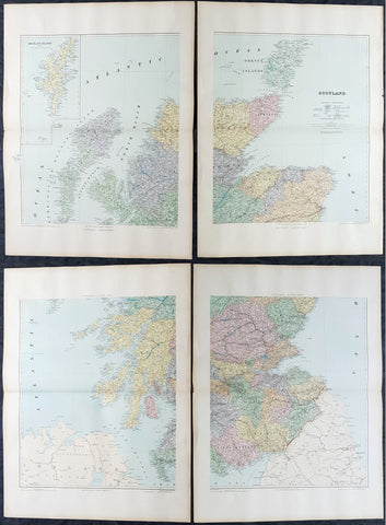
1895 Edward Stanford Very Large 4 Sheet Map of Scotland - w/ Reference Map
- Title : Scotland...London Edward Stanford 26 & 27 Cockspur St Charing Cross SW
- Ref #: 40947
- Size: 29 1/2in x 22in (750mm x 560mm) each sheet
- Date : 1895
- Condition: (A+) Fine Condition
Description:
Extremely scarce 4 sheet, very large (29 1/2in x 22in (750mm x 560mm) each sheet) lithograph map of Scotland by the famous 19th century map publisher Edward Stanford was published in 1895. (The map is not dated but we know that Stanford resided at the address noted on the map Cockspur St from 1885 to 1901). Also included is a smaller (20in x 14in 510mm x 360mm) original reference map that came with the 4 sheet publication.
This is an extremely beautiful, detailed map of Scotland.
General Definitions:
Paper thickness and quality: - Heavy and stable
Paper color : - off white
Age of map color: -
Colors used: -
General color appearance: -
Paper size: - 29 1/2in x 22in (750mm x 560mm) each sheet
Plate size: - 29 1/2in x 22in (750mm x 560mm) each sheet
Margins: - Min 2in (50mm)
Imperfections:
Margins: - None
Plate area: - None
Verso: - None
Stanford, Edward 1827-1904
Stanford was a prominent British mapmaker and publisher. A native of Holborn in the heart of London, Edward was apprenticed to a printer and stationer at the age of 14. After his first master died, he worked with several others, including Trelawny W. Saunders of Charing Cross. Saunders oversaw young Edward’s early career, ensuring that he became a Fellow of the Royal Geographical Society. Associations with the Society eventually brought Sanders much business and gave him a reputation as a publisher of explorers. As testament to this reputation, the Stanford Range in British Columbia was named for him by John Palliser.
Stanford briefly partnered with Saunders in 1852 before striking out on his own in 1853. He was an agent for the Ordnance Survey, the Admiralty, the Geological Survey, the Trigonometrical Survey of India, and the India Office. He also controlled the maps of the Society for the Diffusion of Useful Knowledge, another lucrative source of income. In 1857, Stanford founded his namesake Geographical Establishment, with Saunders and A. K. Johnston as engravers. Thereafter, Stanford was known for his library maps, particularly those of Africa and Asia.
Although he had authored many maps, the Harrow Atlas of Modern Geography and a similar volume on classical geography, Stanford is better remembered today as the leader of a successful map business. Ever in search of more inventory, he acquired the plates and stock of John Arrowsmith, heir of the Arrowmsith family firm, in 1874. By 1881 he employed 87 people at his premises at 6 Charing Cross Road, Saunders’ old address. As he aged, he phased in his son Edward Jr. to run the business. He died in 1904. The business survived him, and the Stanford’s shop is still a prominent London landmark today.
Stanford premises were located in the Strand, London from 1853 to 1884 and then Cockspur St from 1885 to 1901 locating to its present location in Covent Garden.
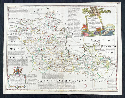
1756 Emmanuel Bowen Large Antique Map of The English County of Berkshire
- Title : An Accurate Map of Berkshire Divided into Hundreds...by Emmanual Bowen....Printed for Carrington Bowles....1756
- Ref #: 27014
- Size: 29in x 22 1/2in (750mm x 570mm)
- Date : 1756
- Condition: (A+) Fine Condition
Description:
This large original beautifully hand coloured antique map of the English County of Berkshire by Emmanuel Bowen was engraved in 1756 - dated at the foot of the map - and was published by Carrington Bowles in The Large English Atlas. (Ref: Tooley; M&B)
General Definitions:
Paper thickness and quality: - Heavy and stable
Paper color : - off white
Age of map color: - Original & later
Colors used: - Yellow, green, blue, pink
General color appearance: - Authentic
Paper size: - 29in x 22 1/2in (750mm x 570mm)
Plate size: - 27 1/2in x 21 1/2in (700mm x 545mm)
Margins: - Min 1in (25mm)
Imperfections:
Margins: - None
Plate area: - None
Verso: - None
Background:
The Large English Atlas was, as its name suggests, a large folio series of county maps conceived in about 1749 but, because of financial problems, not completed until 1760. Hodson describes the atlas as by far the most important eighteenth-century English atlas to be published before the appearance of John Carys New And Correct English Atlas in 1787. Earlier county atlases were predominantly derivative, using old survey work, many in fact, traceable back to Saxtons work of the sixteenth century. The Large English Atlas maps were drawn from the most up-to-date surveys, and so mark an important stage in the development of the county atlas (Hodson). Through its commercial success, this atlas encouraged a new generation of county atlases, of both large and small scales, but of greater precision than before. The maps, drawn either by Emanuel Bowen or Thomas Kitchin, are finely produced. A particular feature is the vast amount of additional detail engraved in the blank areas around the map, lists of the landed gentry, descriptions of the towns, produce and other notable features of each county, and in some cases, fine insets of the county town. All have elaborate title cartouches, illustrating the produce of the county, rural scenes and so on, many signed by Antony Walker Jr. Besides the separately published multi-sheet maps of various counties these are the most detailed and most interesting county maps of the eighteenth century.
Please note all items auctioned are genuine, we do not sell reproductions. A Certificate of Authenticity (COA) can be issued on request.
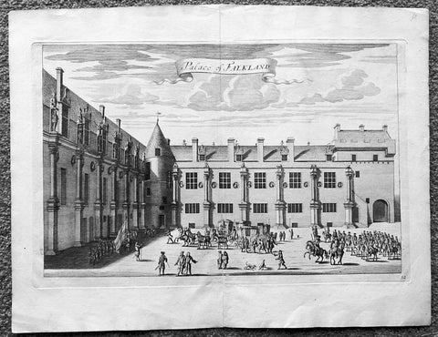
1718 Slezer Antique Print View of Falkland Palace, Fife, Scotland
- Title : Palace of Falkland
- Date : 1718
- Ref # : 24958
- Size : 18 ½in x 14 ½in (470mm x 360mm)
- Condition: (A+) Fine
Description:
This fine beautifully hand coloured original antique print a view of the internal courtyard of Falkland Palace, home of the Scottish Kings - was published in the 1718 edition of John Slezer's 'Theatrum Scotiae'.
Falkland Palace in Falkland, Fife, Scotland, is a former royal palace of the Scottish Kings. The Scottish Crown acquired Falkland Castle from MacDuff of Fife in the 14th century. In 1402 Robert Stewart, 1st Duke of Albany imprisoned his nephew David Stewart, Duke of Rothesay, the eldest son of King Robert III of Scotland, at Falkland. The incarcerated Duke eventually died there from neglect and starvation. Albany was exonerated from blame by Parliament, but suspicions of foul play persisted, suspicions which never left Rothesay's younger brother the future James I of Scotland, and which would eventually lead to the downfall of the Albany Stewarts. John Debrett, writing in 1805, was in no doubt of Duke Robert's motives and guilt. This Robert, Duke of Albany, having obtained the entire government from his brother, King Robert, he caused the Duke of Rothesay to be murdered, thinking to bring the Crown into his own family; but to avoid the like fate, King Robert resolved to send his younger son James, to France, then about nine years old, who being sea-sick, and forced to land on the English coast ... was detained a captive in England eighteen years. At these misfortunes King Robert died of grief in 1406. Between 1501 and 1541 Kings James IV and James V of Scotland transformed the old castle into a beautiful royal palace: with Stirling Castle it was one of only two Renaissance palaces in Scotland. To address the poor state of the garden and park, James V appointed a new Captain and Keeper, William Barclay, Master of Rhynd, in March 1527. Ten years later, James V extended his father's buildings in French renaissance style. He died at Falkland in December 1542 after hearing that his wife had given birth to a daughter—Mary, Queen of Scots. Falkland became a popular retreat with all the Stewart monarchs. They practised falconry there and used the vast surrounding forests for hawking and for hunting deer. Wild boar, imported from France, were kept in the Park, within a fence made by the Laird of Fernie. Nearby Myres Castle is the hereditary home of the Royal Macers and Sergeants at Arms who served Falkland Castle since at least the sixteenth century. John Scrimgeour of Myres supervised building at the Palace from 1532 to 1563. After the Union of the Crowns (1606), James VI and I, Charles I, and Charles II all visited Falkland. A fire partially destroyed the palace during its occupation by Cromwell's troops and it quickly fell into ruin.
This is an important and rare print as Slezer s Theatrum Scotiae is one of the earliest records of early Scottish towns & major buildings. (Ref: Tooley; M&B)
General Description:
Paper thickness and quality: - Heavy and stable
Paper color: - off white
Age of map color: -
Colors used: -
General color appearance: -
Paper size: - 18 ½in x 14 ½in (470mm x 360mm)
Plate size: - 16 ½in x 11in (420mm x 275mm)
Margins: - Min 1in (25mm)
Imperfections: Margins: - None
Plate area: - None
Verso: - None
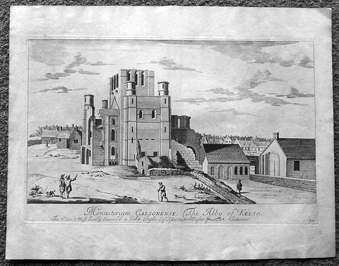
1718 Slezer Antique Print View of Kelso Abby & Township, Scotland
- Title : The Abby of Kelso
- Date : 1718
- Ref # : 24953
- Size : 18 ½in x 14 ½in (470mm x 360mm)
- Condition: (A+) Fine
Description:
This fine beautifully hand coloured original antique print a view of Kelso Abby & Kelso Town, Scotland was published in the 1718 edition of John Slezer's 'Theatrum Scotiae'.
Kelso Abbey is a ruined Scottish abbey in Kelso, Scotland. It was founded in the 12th century by a community of Tironensian monks first brought to Scotland in the reign of Alexander I. It occupies ground overlooking the confluence of the Tweed and Teviot waters, the site of what was once the Royal Burgh of Roxburgh and the intended southern centre for the developing Scottish kingdom at that time. Kelso thus became the seat of a pre-eminently powerful abbacy in the heart of the Scottish Borders.
In the 14th century, Roxburgh became a focus for periodic attack and occupation by English forces and Kelso's monastic community survived a number of fluctuations in control over the area, restoring the abbey infrastructure after episodes of destruction and ultimately retaining Scottish identity. From 1460 onwards, life for the abbey probably grew more settled, but came once again under attack in the early sixteenth century. By the mid-century, through a turbulent combination of events, the abbey effectively ceased to function and the building fell into ruin.
Although the site of Kelso Abbey has not been fully excavated in modern times, evidence suggests that it was a major building with two crossings. The only remains standing today are the west tower crossing and part of the infirmary. The massive design and solid romanesque style of the tower indicate a very large building of formidable, semi-military construction and appearance, evidence of the importance with which Roxburgh was regarded when the abbacy was at the height of its power.
This is an important and rare print as Slezer s Theatrum Scotiae is one of the earliest records of early Scottish towns & major buildings. (Ref: Tooley; M&B)
General Description:
Paper thickness and quality: - Heavy and stable
Paper color: - off white
Age of map color: -
Colors used: -
General color appearance: -
Paper size: - 18 ½in x 14 ½in (470mm x 360mm)
Plate size: - 16 ½in x 11in (420mm x 275mm)
Margins: - Min 1in (25mm)
Imperfections: Margins: - Light age toning
Plate area: - Light age toning
Verso: - Light age toning
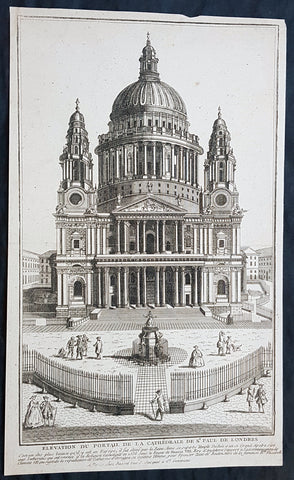
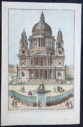
1770 Louis-Joseph Mondhare Antique Print View of St Pauls Cathedral, London England
- Title : Elevation Du Portail De La Cathedrale De St Paul De Londre
- Ref #: 93461
- Size: 14 1/2in x 9in (365mm x 245mm)
- Date : 1770
- Condition: (A+) Fine Condition
Description:
This original copper plate engraved antique print of St Pauls Cathedral, London was engraved and published by Louis-Joseph Mondhare in Paris in 1770
General Definitions:
Paper thickness and quality: - Heavy and stable
Paper color : - off white
Age of map color: -
Colors used: -
General color appearance: -
Paper size: - 14 1/2in x 9in (365mm x 245mm)
Plate size: - 14 1/2in x 9in (365mm x 245mm)
Margins: - Min 1/8in (5mm)
Imperfections:
Margins: - Margins cropped to plate mark
Plate area: - None
Verso: - None
Imperfections:
Margins: - None
Plate area: - None
Verso: - None
Background:
The task of designing a replacement structure was officially assigned to Sir Christopher Wren on 30 July 1669. He had previously been put in charge of the rebuilding of churches to replace those lost in the Great Fire. More than 50 City churches are attributable to Wren. Concurrent with designing St Pauls, Wren was engaged in the production of his five Tracts on Architecture.
Wren had begun advising on the repair of the Old St Pauls in 1661, five years before the fire in 1666. The proposed work included renovations to interior and exterior to complement the classical facade designed by Inigo Jones in 1630. Wren planned to replace the dilapidated tower with a dome, using the existing structure as a scaffold. He produced a drawing of the proposed dome which shows his idea that it should span nave and aisles at the crossing. After the Fire, it was at first thought possible to retain a substantial part of the old cathedral, but ultimately the entire structure was demolished in the early 1670s.
In July 1668 Dean William Sancroft wrote to Wren that he was charged by the Archbishop of Canterbury, in agreement with the Bishops of London and Oxford, to design a new cathedral that was Handsome and noble to all the ends of it and to the reputation of the City and the nation. The design process took several years, but a design was finally settled and attached to a royal warrant, with the proviso that Wren was permitted to make any further changes that he deemed necessary. The result was the present St Pauls Cathedral, still the second largest church in Britain, with a dome proclaimed as the finest in the world. The building was financed by a tax on coal, and was completed within its architects lifetime with many of the major contractors engaged for the duration.
The topping out of the cathedral (when the final stone was placed on the lantern) took place on 26 October 1708, performed by Wrens son Christopher Jr and the son of one of the masons. The cathedral was declared officially complete by Parliament on 25 December 1711 (Christmas Day). In fact, construction continued for several years after that, with the statues on the roof added in the 1720s. In 1716 the total costs amounted to £1,095,556 (£165 million in 2019).
On 2 December 1697, 31 years and 3 months after the Great Fire destroyed Old St Pauls, the new cathedral was consecrated for use. The Right Reverend Henry Compton, Bishop of London, preached the sermon. It was based on the text of Psalm 122, I was glad when they said unto me: Let us go into the house of the Lord. The first regular service was held on the following Sunday.
Opinions of Wrens cathedral differed, with some loving it: Without, within, below, above, the eye / Is filled with unrestrained delight, while others hated it: There was an air of Popery about the gilded capitals, the heavy arches ... They were unfamiliar, un-English
Mondhare & Jean (active 1759 - 1829)
Louis-Joseph Mondhare (1734 - Paris 1799) & Pierre Jean (1754 - 1829) were prominent Parisian publishers, engravers, print and map sellers who were active in Paris in the late 18th and early 19th centuries.
In 1784 Jean married the daughter of Mondhare, who formed a partnership with his son in law, changing forming a very successful partnership thereafter as Mondhare & Jean.
After Mondhare retirement in 1796, Jean carried on with the publishing & printing business, having inherited all of the printing plates that also included many map plates from the likes of Nolin, Clouet, D Anville , Delsile and others. Both Mondhare and Jean were responsible for the engraving and printing of the very decorative large wall maps by J B Nolin & J B L Clouet, as well as single plate maps and atlases. Mondares premises were located at Rue St Jacques, à lHôtel Saumur later movin
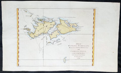
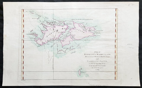
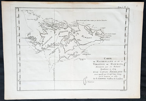
1773 Commodore John Byron 1st Ed Antique Map of The Falkland Islands Sth America
- Title : A chart of Hawkins s Maidenland, discovered by Sr. Richard Hawkins in 1574 and Falkland Sound, so called by Capn. John Strong of the Farewell from London who sailed through it in 1689.
- Ref #: 93385
- Size: 16 1/2in x 10n (405mm x 255mm)
- Date : 1773
- Condition: (A+) Fine Condition
Description:
This original hand coloured copper-plate engraved antique map of the Falkland Islands by Commodore John Byron was engraved by Isaac Noval and published in the 1773 first English edition of John Hawkesworth important book An account of the voyages undertaken by the order of His present Majesty for making discoveries in the Southern Hemisphere, and successively performed by Commodore Byron, Captain Wallis, Captain Carteret, and Captain Cook, in the Dolphin, the Swallow, and the Endeavor. Drawn up from the journals which were kept by the several commanders, and from the papers of Joseph Banks, Esq; by John Hawkesworth, LL.D. In three volumes. Illustrated with cuts, and a great variety of charts and maps relative to countries now first discovered, or hitherto but imperfectly known. London: printed for W. Strahan; and T. Cadell in the Strand, MDCCLXXIII.
John Hawkesworth (1715 - 1773) was commissioned by the British Admiralty to edit Captain James Cooks papers relative to his first voyage. For this work An Account of the Voyages undertaken ... for making discoveries in the Southern Hemisphere and performed by Commodore John Byron, Captain Wallis, Captain Carteret and Captain Cook, from 1702 to 1771, drawn up from the Journals ... (3 vols, 1773) Hawkesworth is said to have received from the publishers the sum of £6000. His descriptions of the manners and customs of the South Seas were, however, regarded by many critics as inexact and hurtful to the interests of morality, and the severity of their strictures is said to have hastened his death. He was buried in the parish church at Bromley, Kent, where he and his wife had kept a school.
General Definitions:
Paper thickness and quality: - Heavy and stable
Paper color : - off white
Age of map color: - Early
Colors used: - Yellow, green, blue, pink
General color appearance: - Authentic
Paper size: - 16 1/2in x 10n (405mm x 255mm)
Plate size: - 12 1/2in x 9 1/2in (310mm x 240mm)
Margins: - Min 1in (25mm)
Imperfections:
Margins: - None
Plate area: - Folds as issued
Verso: - None
Background:
Although Fuegians from Patagonia may have visited the Falkland Islands in prehistoric times, the islands were uninhabited when Europeans first discovered them. Claims of discovery date back to the 16th century, but no consensus exists on whether early explorers discovered the Falklands or other islands in the South Atlantic. The first recorded landing on the islands is attributed to English captain John Strong, who, en route to Perus and Chiles littoral in 1690, discovered the Falkland Sound and noted the islands water and game.
The Falklands remained uninhabited until the 1764 establishment of Port Louis on East Falkland by French captain Louis Antoine de Bougainville, and the 1766 foundation of Port Egmont on Saunders Island by British captain John MacBride. Whether or not the settlements were aware of each others existence is debated by historians. In 1766, France surrendered its claim on the Falklands to Spain, which renamed the French colony Puerto Soledad the following year. Problems began when Spain discovered and captured Port Egmont in 1770. War was narrowly avoided by its restitution to Britain in 1771.
Both the British and Spanish settlements coexisted in the archipelago until 1774, when Britains new economic and strategic considerations led it to voluntarily withdraw from the islands, leaving a plaque claiming the Falklands for King George III. Spains Viceroyalty of the Río de la Plata became the only governmental presence in the territory. West Falkland was left abandoned, and Puerto Soledad became mostly a prison camp. Amid the British invasions of the Río de la Plata during the Napoleonic Wars in Europe, the islands governor evacuated the archipelago in 1806; Spains remaining colonial garrison followed suit in 1811, except for gauchos and fishermen who remained voluntarily.
Thereafter, the archipelago was visited only by fishing ships; its political status was undisputed until 1820, when Colonel David Jewett, an American privateer working for the United Provinces of the Río de la Plata, informed anchored ships about Buenos Aires 1816 claim to Spains territories in the South Atlantic. Since the islands had no permanent inhabitants, in 1823 Buenos Aires granted German-born merchant Luis Vernet permission to conduct fishing activities and exploit feral cattle in the archipelago. Vernet settled at the ruins of Puerto Soledad in 1826, and accumulated resources on the islands until the venture was secure enough to bring settlers and form a permanent colony. Buenos Aires named Vernet military and civil commander of the islands in 1829, and he attempted to regulate sealing to stop the activities of foreign whalers and sealers. Vernets venture lasted until a dispute over fishing and hunting rights led to a raid by the American warship USS Lexington in 1831, when United States Navy commander Silas Duncan declared the dissolution of the islands government.
Buenos Aires attempted to retain influence over the settlement by installing a garrison, but a mutiny in 1832 was followed the next year by the arrival of British forces who reasserted Britains rule. The Argentine Confederation (headed by Buenos Aires Governor Juan Manuel de Rosas) protested against Britains actions and Argentine governments have continued since then to register official protests against Britain. The British troops departed after completing their mission, leaving the area without formal government. Vernets deputy, the Scotsman Matthew Brisbane, returned to the islands that year to restore the business, but his efforts ended after, amid unrest at Port Louis, gaucho Antonio Rivero led a group of dissatisfied individuals to murder Brisbane and the settlements senior leaders; survivors hid in a cave on a nearby island until the British returned and restored order. In 1840, the Falklands became a Crown colony, and Scottish settlers subsequently established an official pastoral community. Four years later, nearly everyone relocated to Port Jackson, considered a better location for government, and merchant Samuel Lafone began a venture to encourage British colonisation.
Stanley, as Port Jackson was soon renamed, officially became the seat of government in 1845. Early in its history, Stanley had a negative reputation due to cargo-shipping losses; only in emergencies would ships rounding Cape Horn stop at the port. Nevertheless, the Falklands geographic location proved ideal for ship repairs and the Wrecking Trade, the business of selling and buying shipwrecks and their cargoes. Aside from this trade, commercial interest in the archipelago was minimal due to the low-value hides of the feral cattle roaming the pastures. Economic growth began only after the Falkland Islands Company, which bought out Lafones failing enterprise in 1851, successfully introduced Cheviot sheep for wool farming, spurring other farms to follow suit. The high cost of importing materials, combined with the shortage of labour and consequent high wages, meant the ship repair trade became uncompetitive. After 1870, it declined as the replacement of sail ships by steamships was accelerated by the low cost of coal in South America; by 1914, with the opening of the Panama Canal, the trade effectively ended. In 1881, the Falkland Islands became financially independent of Britain. For more than a century, the Falkland Islands Company dominated the trade and employment of the archipelago; in addition, it owned most housing in Stanley, which greatly benefited from the wool trade with the UK.
Byron, John 1723 – 1786
Vice-Admiral John Byron (8 November 1723 – 10 April 1786) was a British Royal Navy officer and explorer. He earned the nickname Foul-Weather Jack in the press because of his frequent encounters with bad weather at sea. As a midshipman, he sailed in the squadron under George Anson on his voyage around the world, though Byron made it only to southern Chile, where his ship was wrecked. He returned to England with the captain of HMS Wager. He was governor of Newfoundland following Hugh Palliser, who left in 1768. He circumnavigated the world as a commodore with his own squadron in 1764–1766. He fought in battles in the Seven Years War and the American Revolution. He rose to Vice Admiral of the White before his death in 1786.
His grandsons include the poet George Gordon Byron and George Anson Byron, admiral and explorer, who were the 6th and 7th Baron Byron, respectively.
Byron was the second son of William Byron, 4th Baron Byron and Frances Berkeley, the daughter of William, 4th Baron Berkeley. After studying at Westminster School he joined the Royal Navy at the age of 14, making his first voyage aboard the HMS Romney in 1738–40.
In 1740, he accompanied George Anson on his voyage around the world as a midshipman aboard one of the several ships in the squadron. On 14 May 1741, HMS Wager under Captain Cheap (as Captain Dandy Kidd had died), was shipwrecked on the coast of Chile on what is now called Wager Island and Byron was one of the survivors. The survivors decided to split in two teams, one to make its way by boat to Rio de Janeiro on the Atlantic coast; the other, including John Byron and the Captain, to sail north along the Spanish colonial coast.
Captain Cheap at Wager Island had a party of 19 men after the deserters rejoined the camp. This included the surgeon Elliot and Lieutenant Hamilton who had been cast adrift with him plus midshipmen John Byron and Campbell who had been in the barge. They rowed up the coast but were punished by continuous rain, headwinds and waves that threatened the boats. One night while the men slept on shore, one of the boats was capsized while at anchor and was swept out to sea with its two boatkeepers. One of the men got ashore but the other drowned. As it was now impossible for them all to fit in the remaining boat, four marines were left ashore with muskets to fend for themselves. The winds prevented them from getting around the headland so they returned to pick up the marines only to find them gone. They returned to Wager Island in early February 1742. With one death on the journey, there were now 13 in the group.
Martín Olleta, a Chono cheftain, guided the men up the coast to the Spanish settlements of Chiloé Island so they set out again. Two men died; after burying the bodies, the six seamen rowed off in the boat never to be seen again while Cheap, Hamilton, Byron, Campbell and the dying Elliot were on shore looking for food. Olleta then agreed to take the remaining four on by canoe for their only remaining possession, a musket. It is likely the party travelled across Presidente Ríos Lake in inland Taitao Peninsula, a lake Chile regarded as officially discovered in 1945. Eventually they made it to be taken prisoner by the Spanish. The Spaniards treated them well and they were eventually taken to the inland capital of Santiago where they were released on parole. The Spaniards heard that Anson had been generous in the treatment of the prisoners he had taken and this kindness was returned.
Byron and the other three men stayed in Santiago till late 1744 and were offered passage on a French ship bound for Spain. Three accepted the passage. Campbell elected to take a mule across the Andes and joined the Spanish Admiral Pizarro in Montevideo on the Asia only to find Isaac Morris and the two seamen who had been abandoned in Freshwater Bay on the Atlantic coast. After time in prison in Spain, Campbell reached Britain in May 1746, followed by the other three two months later.
In England, the official court martial examined only the loss of the Wager in which Baynes, in nominal charge at the time, was acquitted of blame but reprimanded for omissions of duty. Disputes over what happened after the wreck were instead played out as Bulkeley and Cummins, Campbell, Morris, the cooper Young and later Byron published their own accounts, the last of which was the only one that in any way defended Cheap who had since died. Twenty-nine crew members plus seven marines made it back to England.
Byrons account of his adventures and the Wager Mutiny are recounted in The Narrative of the Honourable John Byron (1768). His book sold well enough to be printed in several editions.
Byron was appointed captain of HMS Siren in December 1746.
In 1760, during the Seven Years War, Byron commanded a squadron sent to destroy the fortifications at Louisbourg, Quebec, which had been captured by the British two years before. They wanted to ensure it could not be used by the French in Canada. In July of that year he defeated the French flotilla sent to relieve New France at the Battle of Restigouche.
In early 1764 the British Admiralty determined that it would require a permanent naval settlement off the South American coast, in order to resupply naval vessels seeking to enter the Pacific via Cape Horn. Captain Byron was selected to explore the South Atlantic for a suitable island upon which to establish such a settlement. The South American mainland was controlled by Spain, which was hostile to local expansion of British interests; to disguise Byrons mission it was announced that he had been appointed the new Navy Commander-in-Chief, East Indies. Byron set sail in June 1764, ostensibly to take up the East Indies post. For the voyage he was granted command of the 24-gun frigate HMS Dolphin and the 16-gun sloop HMS Tamar.
Byrons two-vessel flotilla crossed the Atlantic over the winter of 1764 and made its way slowly down the South American coast. The Admiralty had ordered Byron to first seek Pepys Island, reputedly discovered off the Patagonian coast by the corsair Ambrose Cowley in 1683. Byron reached the co-ordinates given by Cowley in January 1765, but there was no sign of the island and the search was swiftly abandoned. On 5 February Byron reached the Patagonian settlement of Port Desire where he resupplied his vessels from the storeship HMS Florida.
Between June 1764 and May 1766, Byron completed his own circumnavigation of the globe as captain of HMS Dolphin. This was the first such circumnavigation that was accomplished in less than 2 years. His actions nearly caused a war between Great Britain and Spain, as both countries had armed fleets ready to contest the sovereignty of the Falkland Islands. Later Byron encountered islands and extant residents of the Tuamotus and Tokelau Islands, and Nikunau in the southern Gilbert Islands; he also visited Tinian in the Northern Marianas Islands. A notable member of Byrons crew was Masters Mate Erasmus Gower whom Byron chose to take a significant part in the ceremony when he took possession of the Falkland Islands. Byron had examined Gower for his lieutenants examination in 1762 and was so impressed that he chose him to accompany him on his own circumnavigation (1764–65) and ensured that he was appointed as lieutenant to Commander Philip Carteret immediately afterwards in the next circumnavigation (1766–69).
In 1769 he was appointed governor of Newfoundland off the mainland of Canada, an office he held for the next three years.
He was promoted to rear admiral on 31 March 1775. In 1779, he served as Commander-in-chief of the Leeward Islands Station during the American War of Independence. After being severely injured during a storm on his way to the West Indies, Byron unsuccessfully attacked a French fleet under the Comte dEstaing at the Battle of Grenada in July 1779. He subsequently resigned his post and returned to England, where he suffered from poor health for the rest of his life.
Byron was briefly Commander-in-Chief, North American Station from 1 October 1779. He was made vice admiral of the white in September 1780.
John Byron died on 1 April 1786 at home in Bolton Row, London. His remains were buried in the Berkeley family vault situated beneath the chancel of the Church of St Mary the Virgin, Twickenham, on 10 April.
Johns life was a great inspiration for his grandson the poet George Gordon Byron, though they never met. The poet both drew from his grandfathers experiences in his writing, using his Narrative for the shipwreck scene in Don Juan, and wrote of the kinship he felt in having such a turbulent, unlucky life: he wrote in an epistle to his half-sister Augusta Leigh that he had no rest at sea, nor I on shore.
1773 Commodore John Byron 1st Ed Antique Map of The Falkland Islands Sth America
- Title : A chart of Hawkins s Maidenland, discovered by Sr. Richard Hawkins in 1574 and Falkland Sound, so called by Capn. John Strong of the Farewell from London who sailed through it in 1689.
- Ref #: 93384
- Size: 16 1/2in x 10n (405mm x 255mm)
- Date : 1773
- Condition: (A+) Fine Condition
Description:
This original hand coloured copper-plate engraved antique map of the Falkland Islands by Commodore John Byron was engraved by Isaac Noval and published in the 1773 first English edition of John Hawkesworth important book An account of the voyages undertaken by the order of His present Majesty for making discoveries in the Southern Hemisphere, and successively performed by Commodore Byron, Captain Wallis, Captain Carteret, and Captain Cook, in the Dolphin, the Swallow, and the Endeavor. Drawn up from the journals which were kept by the several commanders, and from the papers of Joseph Banks, Esq; by John Hawkesworth, LL.D. In three volumes. Illustrated with cuts, and a great variety of charts and maps relative to countries now first discovered, or hitherto but imperfectly known. London: printed for W. Strahan; and T. Cadell in the Strand, MDCCLXXIII.
John Hawkesworth (1715 - 1773) was commissioned by the British Admiralty to edit Captain James Cooks papers relative to his first voyage. For this work An Account of the Voyages undertaken ... for making discoveries in the Southern Hemisphere and performed by Commodore John Byron, Captain Wallis, Captain Carteret and Captain Cook, from 1702 to 1771, drawn up from the Journals ... (3 vols, 1773) Hawkesworth is said to have received from the publishers the sum of £6000. His descriptions of the manners and customs of the South Seas were, however, regarded by many critics as inexact and hurtful to the interests of morality, and the severity of their strictures is said to have hastened his death. He was buried in the parish church at Bromley, Kent, where he and his wife had kept a school.
General Definitions:
Paper thickness and quality: - Heavy and stable
Paper color : - off white
Age of map color: - Early
Colors used: - Yellow, green, blue, pink
General color appearance: - Authentic
Paper size: - 16 1/2in x 10n (405mm x 255mm)
Plate size: - 12 1/2in x 9 1/2in (310mm x 240mm)
Margins: - Min 1in (25mm)
Imperfections:
Margins: - None
Plate area: - Folds as issued
Verso: - None
Background:
Although Fuegians from Patagonia may have visited the Falkland Islands in prehistoric times, the islands were uninhabited when Europeans first discovered them. Claims of discovery date back to the 16th century, but no consensus exists on whether early explorers discovered the Falklands or other islands in the South Atlantic. The first recorded landing on the islands is attributed to English captain John Strong, who, en route to Perus and Chiles littoral in 1690, discovered the Falkland Sound and noted the islands water and game.
The Falklands remained uninhabited until the 1764 establishment of Port Louis on East Falkland by French captain Louis Antoine de Bougainville, and the 1766 foundation of Port Egmont on Saunders Island by British captain John MacBride. Whether or not the settlements were aware of each others existence is debated by historians. In 1766, France surrendered its claim on the Falklands to Spain, which renamed the French colony Puerto Soledad the following year. Problems began when Spain discovered and captured Port Egmont in 1770. War was narrowly avoided by its restitution to Britain in 1771.
Both the British and Spanish settlements coexisted in the archipelago until 1774, when Britains new economic and strategic considerations led it to voluntarily withdraw from the islands, leaving a plaque claiming the Falklands for King George III. Spains Viceroyalty of the Río de la Plata became the only governmental presence in the territory. West Falkland was left abandoned, and Puerto Soledad became mostly a prison camp. Amid the British invasions of the Río de la Plata during the Napoleonic Wars in Europe, the islands governor evacuated the archipelago in 1806; Spains remaining colonial garrison followed suit in 1811, except for gauchos and fishermen who remained voluntarily.
Thereafter, the archipelago was visited only by fishing ships; its political status was undisputed until 1820, when Colonel David Jewett, an American privateer working for the United Provinces of the Río de la Plata, informed anchored ships about Buenos Aires 1816 claim to Spains territories in the South Atlantic. Since the islands had no permanent inhabitants, in 1823 Buenos Aires granted German-born merchant Luis Vernet permission to conduct fishing activities and exploit feral cattle in the archipelago. Vernet settled at the ruins of Puerto Soledad in 1826, and accumulated resources on the islands until the venture was secure enough to bring settlers and form a permanent colony. Buenos Aires named Vernet military and civil commander of the islands in 1829, and he attempted to regulate sealing to stop the activities of foreign whalers and sealers. Vernets venture lasted until a dispute over fishing and hunting rights led to a raid by the American warship USS Lexington in 1831, when United States Navy commander Silas Duncan declared the dissolution of the islands government.
Buenos Aires attempted to retain influence over the settlement by installing a garrison, but a mutiny in 1832 was followed the next year by the arrival of British forces who reasserted Britains rule. The Argentine Confederation (headed by Buenos Aires Governor Juan Manuel de Rosas) protested against Britains actions and Argentine governments have continued since then to register official protests against Britain. The British troops departed after completing their mission, leaving the area without formal government. Vernets deputy, the Scotsman Matthew Brisbane, returned to the islands that year to restore the business, but his efforts ended after, amid unrest at Port Louis, gaucho Antonio Rivero led a group of dissatisfied individuals to murder Brisbane and the settlements senior leaders; survivors hid in a cave on a nearby island until the British returned and restored order. In 1840, the Falklands became a Crown colony, and Scottish settlers subsequently established an official pastoral community. Four years later, nearly everyone relocated to Port Jackson, considered a better location for government, and merchant Samuel Lafone began a venture to encourage British colonisation.
Stanley, as Port Jackson was soon renamed, officially became the seat of government in 1845. Early in its history, Stanley had a negative reputation due to cargo-shipping losses; only in emergencies would ships rounding Cape Horn stop at the port. Nevertheless, the Falklands geographic location proved ideal for ship repairs and the Wrecking Trade, the business of selling and buying shipwrecks and their cargoes. Aside from this trade, commercial interest in the archipelago was minimal due to the low-value hides of the feral cattle roaming the pastures. Economic growth began only after the Falkland Islands Company, which bought out Lafones failing enterprise in 1851, successfully introduced Cheviot sheep for wool farming, spurring other farms to follow suit. The high cost of importing materials, combined with the shortage of labour and consequent high wages, meant the ship repair trade became uncompetitive. After 1870, it declined as the replacement of sail ships by steamships was accelerated by the low cost of coal in South America; by 1914, with the opening of the Panama Canal, the trade effectively ended. In 1881, the Falkland Islands became financially independent of Britain. For more than a century, the Falkland Islands Company dominated the trade and employment of the archipelago; in addition, it owned most housing in Stanley, which greatly benefited from the wool trade with the UK.
Byron, John 1723 – 1786
Vice-Admiral John Byron (8 November 1723 – 10 April 1786) was a British Royal Navy officer and explorer. He earned the nickname Foul-Weather Jack in the press because of his frequent encounters with bad weather at sea. As a midshipman, he sailed in the squadron under George Anson on his voyage around the world, though Byron made it only to southern Chile, where his ship was wrecked. He returned to England with the captain of HMS Wager. He was governor of Newfoundland following Hugh Palliser, who left in 1768. He circumnavigated the world as a commodore with his own squadron in 1764–1766. He fought in battles in the Seven Years War and the American Revolution. He rose to Vice Admiral of the White before his death in 1786.
His grandsons include the poet George Gordon Byron and George Anson Byron, admiral and explorer, who were the 6th and 7th Baron Byron, respectively.
Byron was the second son of William Byron, 4th Baron Byron and Frances Berkeley, the daughter of William, 4th Baron Berkeley. After studying at Westminster School he joined the Royal Navy at the age of 14, making his first voyage aboard the HMS Romney in 1738–40.
In 1740, he accompanied George Anson on his voyage around the world as a midshipman aboard one of the several ships in the squadron. On 14 May 1741, HMS Wager under Captain Cheap (as Captain Dandy Kidd had died), was shipwrecked on the coast of Chile on what is now called Wager Island and Byron was one of the survivors. The survivors decided to split in two teams, one to make its way by boat to Rio de Janeiro on the Atlantic coast; the other, including John Byron and the Captain, to sail north along the Spanish colonial coast.
Captain Cheap at Wager Island had a party of 19 men after the deserters rejoined the camp. This included the surgeon Elliot and Lieutenant Hamilton who had been cast adrift with him plus midshipmen John Byron and Campbell who had been in the barge. They rowed up the coast but were punished by continuous rain, headwinds and waves that threatened the boats. One night while the men slept on shore, one of the boats was capsized while at anchor and was swept out to sea with its two boatkeepers. One of the men got ashore but the other drowned. As it was now impossible for them all to fit in the remaining boat, four marines were left ashore with muskets to fend for themselves. The winds prevented them from getting around the headland so they returned to pick up the marines only to find them gone. They returned to Wager Island in early February 1742. With one death on the journey, there were now 13 in the group.
Martín Olleta, a Chono cheftain, guided the men up the coast to the Spanish settlements of Chiloé Island so they set out again. Two men died; after burying the bodies, the six seamen rowed off in the boat never to be seen again while Cheap, Hamilton, Byron, Campbell and the dying Elliot were on shore looking for food. Olleta then agreed to take the remaining four on by canoe for their only remaining possession, a musket. It is likely the party travelled across Presidente Ríos Lake in inland Taitao Peninsula, a lake Chile regarded as officially discovered in 1945. Eventually they made it to be taken prisoner by the Spanish. The Spaniards treated them well and they were eventually taken to the inland capital of Santiago where they were released on parole. The Spaniards heard that Anson had been generous in the treatment of the prisoners he had taken and this kindness was returned.
Byron and the other three men stayed in Santiago till late 1744 and were offered passage on a French ship bound for Spain. Three accepted the passage. Campbell elected to take a mule across the Andes and joined the Spanish Admiral Pizarro in Montevideo on the Asia only to find Isaac Morris and the two seamen who had been abandoned in Freshwater Bay on the Atlantic coast. After time in prison in Spain, Campbell reached Britain in May 1746, followed by the other three two months later.
In England, the official court martial examined only the loss of the Wager in which Baynes, in nominal charge at the time, was acquitted of blame but reprimanded for omissions of duty. Disputes over what happened after the wreck were instead played out as Bulkeley and Cummins, Campbell, Morris, the cooper Young and later Byron published their own accounts, the last of which was the only one that in any way defended Cheap who had since died. Twenty-nine crew members plus seven marines made it back to England.
Byrons account of his adventures and the Wager Mutiny are recounted in The Narrative of the Honourable John Byron (1768). His book sold well enough to be printed in several editions.
Byron was appointed captain of HMS Siren in December 1746.
In 1760, during the Seven Years War, Byron commanded a squadron sent to destroy the fortifications at Louisbourg, Quebec, which had been captured by the British two years before. They wanted to ensure it could not be used by the French in Canada. In July of that year he defeated the French flotilla sent to relieve New France at the Battle of Restigouche.
In early 1764 the British Admiralty determined that it would require a permanent naval settlement off the South American coast, in order to resupply naval vessels seeking to enter the Pacific via Cape Horn. Captain Byron was selected to explore the South Atlantic for a suitable island upon which to establish such a settlement. The South American mainland was controlled by Spain, which was hostile to local expansion of British interests; to disguise Byrons mission it was announced that he had been appointed the new Navy Commander-in-Chief, East Indies. Byron set sail in June 1764, ostensibly to take up the East Indies post. For the voyage he was granted command of the 24-gun frigate HMS Dolphin and the 16-gun sloop HMS Tamar.
Byrons two-vessel flotilla crossed the Atlantic over the winter of 1764 and made its way slowly down the South American coast. The Admiralty had ordered Byron to first seek Pepys Island, reputedly discovered off the Patagonian coast by the corsair Ambrose Cowley in 1683. Byron reached the co-ordinates given by Cowley in January 1765, but there was no sign of the island and the search was swiftly abandoned. On 5 February Byron reached the Patagonian settlement of Port Desire where he resupplied his vessels from the storeship HMS Florida.
Between June 1764 and May 1766, Byron completed his own circumnavigation of the globe as captain of HMS Dolphin. This was the first such circumnavigation that was accomplished in less than 2 years. His actions nearly caused a war between Great Britain and Spain, as both countries had armed fleets ready to contest the sovereignty of the Falkland Islands. Later Byron encountered islands and extant residents of the Tuamotus and Tokelau Islands, and Nikunau in the southern Gilbert Islands; he also visited Tinian in the Northern Marianas Islands. A notable member of Byrons crew was Masters Mate Erasmus Gower whom Byron chose to take a significant part in the ceremony when he took possession of the Falkland Islands. Byron had examined Gower for his lieutenants examination in 1762 and was so impressed that he chose him to accompany him on his own circumnavigation (1764–65) and ensured that he was appointed as lieutenant to Commander Philip Carteret immediately afterwards in the next circumnavigation (1766–69).
In 1769 he was appointed governor of Newfoundland off the mainland of Canada, an office he held for the next three years.
He was promoted to rear admiral on 31 March 1775. In 1779, he served as Commander-in-chief of the Leeward Islands Station during the American War of Independence. After being severely injured during a storm on his way to the West Indies, Byron unsuccessfully attacked a French fleet under the Comte dEstaing at the Battle of Grenada in July 1779. He subsequently resigned his post and returned to England, where he suffered from poor health for the rest of his life.
Byron was briefly Commander-in-Chief, North American Station from 1 October 1779. He was made vice admiral of the white in September 1780.
John Byron died on 1 April 1786 at home in Bolton Row, London. His remains were buried in the Berkeley family vault situated beneath the chancel of the Church of St Mary the Virgin, Twickenham, on 10 April.
Johns life was a great inspiration for his grandson the poet George Gordon Byron, though they never met. The poet both drew from his grandfathers experiences in his writing, using his Narrative for the shipwreck scene in Don Juan, and wrote of the kinship he felt in having such a turbulent, unlucky life: he wrote in an epistle to his half-sister Augusta Leigh that he had no rest at sea, nor I on shore.
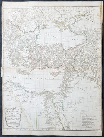
1764 D Anville Large Antique Map Byzantine, Eastern Roman Empire Europe to Egypt
- Title : Orbis Romani Pars Orientalis...Auctor D Anville...MDCCLXIV (1764)
- Size: 29in x 22in (740mm x 560mm)
- Condition: (A) Very Good Condition
- Date : 1764
- Ref #: 92295
Description:
This large hand coloured original copper-plate engraved antique map of the Eastern part of the post Roman Empire, from Eastern Europe to the Holy Land by Jean Baptiste Bourguignon D Anville was engraved in 1764 - dated in the tile cartouche - and was published in Jean-Baptiste Bourguinon D Anvilles large elephant folio atlas Atlas Generale. (Ref: Tooley, M&B)
General Definitions:
Paper thickness and quality: - Heavy and stable
Paper color : - off white
Age of map color: - Original
Colors used: - Yellow, Green, pink
General color appearance: - Authentic
Paper size: - 29in x 22in (740mm x 560mm)
Plate size: - 28in x 22in (730mm x 560mm)
Margins: - Min 1/4in (3mm)
Imperfections:
Margins: - Soiling in margins, L&R margins cropped close to border
Plate area: - Soiling bottom & top left
Verso: - Soiling
The Roman Empire was the post-Roman Republic period of the ancient Roman civilization, with a government headed by emperors and large territorial holdings around the Mediterranean Sea in Europe, Africa and Asia. The city of Rome was the largest city in the world c. 100 BC – c. AD 400, with Constantinople (New Rome) becoming the largest around AD 500, and the Empire\\\'s population grew to an estimated 50 to 90 million inhabitants (roughly 20% of the world\\\'s population at the time) The 500-year-old republic which preceded it had been severely destabilized in a series of civil wars and political conflict, during which Julius Caesar was appointed as perpetual dictator and then assassinated in 44 BC. Civil wars and executions continued, culminating in the victory of Octavian, Caesar\\\'s adopted son, over Mark Antony and Cleopatra at the Battle of Actium in 31 BC and the annexation of Egypt. Octavian\\\'s power was then unassailable and in 27 BC the Roman Senate formally granted him overarching power and the new title Augustus, effectively marking the end of the Roman Republic.
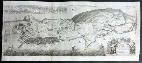
1728 Hermann Moll Large Antique Map and View of Gibraltar - 2nd Spanish Seige
- Title : A New and Exact plan of Gibraltar with all its fortifications as they are at present….
- Ref #: 40838
- Size: 25in x 11in (635mm x 280mm)
- Date : 1727
- Condition: (B) Good Condition
Description:
This finely engraved original antique map and view of the second Spanish siege of Gibraltar by Herman Moll was published in 1727.
Although undated, the legend at the top left of the map, gives an in-depth explanation to the map including no. 5 that refers to 'Place where at this time Barracks building for a Regiment Ap: 15. 1726. 6. The Great Church.', while the dedication is to David Colyear, 1st Earl of Portmore, Governor of Gibraltar. The plan was presumably engraved either in anticipation of, or during the second Spanish siege; Portmore was in England when the siege began, but sailed there with a relief force, arriving on 1st May, 1727. British command of the sea, coupled with the natural features of the Rock of Gibraltar on the landward side of the peninsula, combined to thwart Spanish ambition, and the siege petered to an end in 1728, with the garrison never seriously troubled.
Background: Gibraltar became part of the Visigothic Kingdom of Hispania following the collapse of the Roman Empire and came under Muslim Moorish rule in 711 AD. It was permanently settled for the first time by the Moors and was renamed Jebel Tariq – the Mount of Tariq, later corrupted into Gibraltar. The Christian Crown of Castile annexed it in 1309, lost it again to the Moors in 1333 and finally regained it in 1462. Gibraltar became part of the unified Kingdom of Spain and remained under Spanish rule until 1704. It was captured during the War of the Spanish Succession by an Anglo-Dutch fleet in the name of Charles VI of Austria, the Habsburg contender to the Spanish throne. At the war's end, Spain ceded the territory to Britain under the terms of the Treaty of Utrecht of 1713.
Spain tried to regain control of Gibraltar, which Britain had declared a Crown colony, through military, diplomatic and economic pressure. Gibraltar was besieged and heavily bombarded during three wars between Britain and Spain but the attacks were repulsed on each occasion. By the end of the last siege, in the late 18th century, Gibraltar had faced fourteen sieges in 500 years. In the years after Trafalgar, Gibraltar became a major base in the Peninsular War. The colony grew rapidly during the 19th and early 20th centuries, becoming one of Britain's most important possessions in the Mediterranean. It was a key stopping point for vessels en route to India via the Suez Canal. A large British naval base was constructed there at great expense at the end of the 19th century and became the backbone of Gibraltar's economy.
British control of Gibraltar enabled the Allies to control the entrance to the Mediterranean during the Second World War. It was attacked on several occasions by German, Italian and Vichy French forces, though without causing much damage. The Spanish dictator General Francisco Franco declined to join a Nazi plan to occupy Gibraltar but revived Spain's claim to the territory after the war. As the territorial dispute intensified, Spain closed its border with Gibraltar between 1969 and 1985 and communications links were severed. Spain's position was supported by Latin American countries but was rejected by Britain and the Gibraltarians themselves, who vigorously asserted their right to self-determination. Discussions of Gibraltar's status have continued between Britain and Spain but have not reached any conclusion.
Shortly after Gibraltar's recapture, King Henry IV of Castile declared it Crown property and reinstituted the special privileges which his predecessor had granted during the previous period of Christian rule. Four years after visiting Gibraltar in 1463, he was overthrown by the Spanish nobility and clergy. His half-brother Alfonso was declared king and rewarded Medina Sidonia for his support with the lordship of Gibraltar. The existing governor, a loyalist of the deposed Henry IV, refused to surrender Gibraltar to Medina Sidonia. After a fifteen-month siege from April 1466 to July 1467, Medina Sidonia took control of the town. He died the following year but his son Enrique was confirmed as lord of Gibraltar by the reinstated Henry IV in 1469. In 1474 the new Duke of Medina Sidonia sold Gibraltar to a group of Jewish conversos from Cordova and Seville led by Pedro de Herrera in exchange for maintaining the garrison of the town for two years, after which time the 4,350 conversos were expelled by the Duke. His status was further enhanced by Isabella I of Castile in 1478 with the granting of the Marquisate of Gibraltar.
On 2 January 1492, after five years of war, the Moorish emirate in Spain came to an end with the Catholic Monarchs' capture of Granada. The Jews of Gibraltar were, like those elsewhere in the kingdom, expelled from Spain by order of the monarchs in March that year. Gibraltar was used by Medina Sidonia as a base for the Spanish capture of Melilla in North Africa in 1497. Two years later the Muslims of Granada were ordered to convert to Christianity or leave. Those that did not convert left for North Africa, some of them travelling via Gibraltar.
Gibraltar became Crown property again in 1501 at the order of Isabella and the following year it received a new set of royal arms, which is still used by modern Gibraltar, replacing those of Medina Sidonia. In the Royal Warrant accompanying the arms, Isabella highlighted Gibraltar's importance as "the key between these our kingdoms in the Eastern and Western Seas [the Mediterranean and Atlantic]". The metaphor was represented on the royal arms by a golden key hanging from the front gate of a battlemented fortress. The warrant charged all future Spanish monarchs to "hold and retain the said City for themselves and in their own possession; and that no alienation of it, nor any part of it, nor its jurisdiction ... shall ever be made from the Crown of Castile."
At this point in history, "Gibraltar" meant not just the peninsula but the entire surrounding area including the land on which the towns of La Línea de la Concepción, San Roque, Los Barrios and Algeciras now stand. To the east, Gibraltar was bounded by the Guadiaro River, and its northern boundaries lay in the vicinity of Castellar de la Frontera, Jimena de la Frontera, Alcalá de los Gazules, Medina-Sidonia and Tarifa. From the 16th century, the modern meaning of the name came to be adopted – specifically referring only to the town of Gibraltar and the peninsula on which it stands.
Under Spanish Crown rule, the town of Gibraltar fell into severe decline. The end of Muslim rule in Spain and the Christian capture of the southern ports considerably decreased the peninsula's strategic value. It derived some minor economic value from tuna-fishing and wine-producing industries but its usefulness as a fortress was now limited. It was effectively reduced to the status of an unremarkable stronghold on a rocky promontory and Marbella replaced it as the principal Spanish port in the region.
Gibraltar's inhospitable terrain made it an unpopular place to live. To boost the population, convicts from the kingdom of Granada were offered the possibility of serving their sentence in the Gibraltar garrison as an alternative to prison. Despite its apparent unattractiveness, Juan Alfonso de Guzmán, third Duke of Medina Sidonia, nonetheless sought to regain control of the town. In September 1506, following Isabella's death, he laid siege in the expectation that the gates would quickly be opened to his forces. This did not happen, and after a fruitless four-month blockade he gave up the attempt. Gibraltar received the title of "Most Loyal" from the Spanish crown in recognition of its faithfulness (Ref: M&B, Tooley)
General Description:
Paper thickness and quality: - Heavy and stable
Paper color: - off white
Age of map color: -
Colors used: -
General color appearance: -
Paper size: - 25in x 11in (635mm x 280mm)
Plate size: - 25in x 11in (635mm x 280mm)
Margins: - Min 1/4in (5mm)
Imperfections:
Margins: - None
Plate area: - Small loss to the very right figure in the title cartouche not affecting the map, light creasing along folds as issued
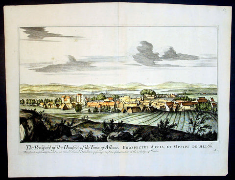
1693 Slezer Antique Print View of the Town of Alloa on Firth of Forth Scotland
- Title : The Prospect of the House & of the Town of Alloua
- Ref : 24947
- Size: 18 ½in x 14 ½in (470mm x 370mm)
- Date : 1693
- Condition: (A+) Fine Condition
Description:
This finely engraved original important antique print a view of the town of Alloa in Clackmannanshire in eastern Scotland on the Firth of Forth, was published in the first edition of John Slezer's 'Theatrum Scotiae', 1693.
This is an important and rare print as Slezer s Theatrum Scotiae is one of the earliest records of early Scottish towns. (Ref: Tooley; M&B)
General Description:
Paper thickness and quality: - Heavy and stable
Paper color: - off white
Age of map color: -
Colors used: -
General color appearance: -
Paper size: - 18 ½in x 14 ½in (470mm x 370mm)
Plate size: - 16 ½in x 11 in (420mm x 280mm)
Margins: - Min 1in (25mm)
Imperfections:
Margins: - None
Plate area: - None
Verso: - None
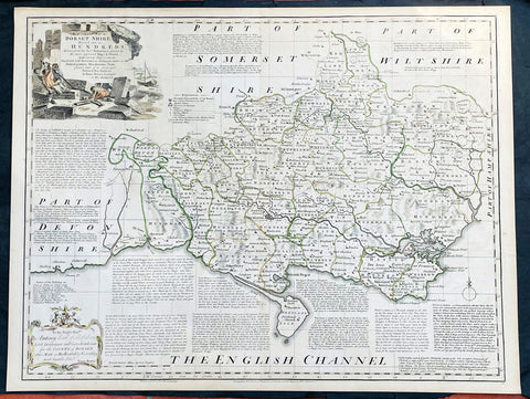
1760 Emanuel Bowen Large English County Map of Dorset Shire
- Title : An Accurate Map of Dorsetshire, Divided into its Hundreds. Drawn from the best Authorities, assisted by the most approved Maps and Charts with various Improvements illustrated with Historical Extracts relative to its Natural Produce, Manufactures, Trade, present state of it’s principal Towns and Sea Ports, by Eman Bowen geographer to His Majesty.
- Date : 1760
- Size: 29in x 22 1/2in (750mm x 570mm)
- Condition: (A+) Fine Condition
- Ref: 35614
Description:
This large original beautifully hand coloured antique map of the English County of Dorset Shire by Emmanuel Bowen was published by Carrington Bowles in the 1760 edition of The Large English Atlas. (Ref: Tooley; M&B)
General Definitions:
Paper thickness and quality: - Heavy and stable
Paper color : - off white
Age of map color: - Original
Colors used: - Pink, blue, green, yellow
General color appearance: - Authentic
Paper size: - 29in x 22 1/2in (750mm x 570mm)
Plate size: - 27 1/2in x 21 1/2in (700mm x 545mm)
Margins: - Min 1/2in (12mm)
Imperfections:
Margins: - Light age toning in margins
Plate area: - None
Verso: - None
Background:
The Large English Atlas was, as its name suggests, a large folio series of county maps conceived in about 1749 but, because of financial problems, not completed until 1760. Hodson describes the atlas as by far the most important eighteenth-century English atlas to be published before the appearance of John Carys New And Correct English Atlas in 1787. Earlier county atlases were predominantly derivative, using old survey work, many in fact, traceable back to Saxtons work of the sixteenth century. The Large English Atlas maps were drawn from the most up-to-date surveys, and so mark an important stage in the development of the county atlas (Hodson). Through its commercial success, this atlas encouraged a new generation of county atlases, of both large and small scales, but of greater precision than before. The maps, drawn either by Emanuel Bowen or Thomas Kitchin, are finely produced. A particular feature is the vast amount of additional detail engraved in the blank areas around the map, lists of the landed gentry, descriptions of the towns, produce and other notable features of each county, and in some cases, fine insets of the county town. All have elaborate title cartouches, illustrating the produce of the county, rural scenes and so on, many signed by Antony Walker Jr. Besides the separately published multi-sheet maps of various counties these are the most detailed and most interesting county maps of the eighteenth century.
1770 Louis-Joseph Mondhare Antique Print View of St Pauls Cathedral, London UK
- Title : Le Portail de la grande Eglise de St Paul de Londre...a Paris chez Mondhare ru st Jacques
- Ref #: 93460
- Size: 15in x 9 1/2in (380mm x 235mm)
- Date : 1770
- Condition: (A+) Fine Condition
Description:
This original hand coloured copper plate engraved antique print of St Pauls Cathedral, London was engraved and published by Louis-Joseph Mondhare in Paris in 1770
General Definitions:
Paper thickness and quality: - Heavy and stable
Paper color : - off white
Age of map color: - Early
Colors used: - Blue, pink, red, green, yellow
General color appearance: - Authentic
Paper size: - 15in x 9 1/2in (380mm x 235mm)
Plate size: - 13in x 9in (330mm x 230mm)
Margins: - Min 1/2in (12mm)
Imperfections:
Margins: - None
Plate area: - None
Verso: - None
Background:
The task of designing a replacement structure was officially assigned to Sir Christopher Wren on 30 July 1669. He had previously been put in charge of the rebuilding of churches to replace those lost in the Great Fire. More than 50 City churches are attributable to Wren. Concurrent with designing St Pauls, Wren was engaged in the production of his five Tracts on Architecture.
Wren had begun advising on the repair of the Old St Pauls in 1661, five years before the fire in 1666. The proposed work included renovations to interior and exterior to complement the classical facade designed by Inigo Jones in 1630. Wren planned to replace the dilapidated tower with a dome, using the existing structure as a scaffold. He produced a drawing of the proposed dome which shows his idea that it should span nave and aisles at the crossing. After the Fire, it was at first thought possible to retain a substantial part of the old cathedral, but ultimately the entire structure was demolished in the early 1670s.
In July 1668 Dean William Sancroft wrote to Wren that he was charged by the Archbishop of Canterbury, in agreement with the Bishops of London and Oxford, to design a new cathedral that was Handsome and noble to all the ends of it and to the reputation of the City and the nation. The design process took several years, but a design was finally settled and attached to a royal warrant, with the proviso that Wren was permitted to make any further changes that he deemed necessary. The result was the present St Pauls Cathedral, still the second largest church in Britain, with a dome proclaimed as the finest in the world. The building was financed by a tax on coal, and was completed within its architects lifetime with many of the major contractors engaged for the duration.
The topping out of the cathedral (when the final stone was placed on the lantern) took place on 26 October 1708, performed by Wrens son Christopher Jr and the son of one of the masons. The cathedral was declared officially complete by Parliament on 25 December 1711 (Christmas Day). In fact, construction continued for several years after that, with the statues on the roof added in the 1720s. In 1716 the total costs amounted to £1,095,556 (£165 million in 2019).
On 2 December 1697, 31 years and 3 months after the Great Fire destroyed Old St Pauls, the new cathedral was consecrated for use. The Right Reverend Henry Compton, Bishop of London, preached the sermon. It was based on the text of Psalm 122, I was glad when they said unto me: Let us go into the house of the Lord. The first regular service was held on the following Sunday.
Opinions of Wrens cathedral differed, with some loving it: Without, within, below, above, the eye / Is filled with unrestrained delight, while others hated it: There was an air of Popery about the gilded capitals, the heavy arches ... They were unfamiliar, un-English
Mondhare & Jean (active 1759 - 1829)
Louis-Joseph Mondhare (1734 - Paris 1799) & Pierre Jean (1754 - 1829) were prominent Parisian publishers, engravers, print and map sellers who were active in Paris in the late 18th and early 19th centuries.
In 1784 Jean married the daughter of Mondhare, who formed a partnership with his son in law, changing forming a very successful partnership thereafter as Mondhare & Jean.
After Mondhare retirement in 1796, Jean carried on with the publishing & printing business, having inherited all of the printing plates that also included many map plates from the likes of Nolin, Clouet, D Anville , Delsile and others. Both Mondhare and Jean were responsible for the engraving and printing of the very decorative large wall maps by J B Nolin & J B L Clouet, as well as single plate maps and atlases. Mondares premises were located at Rue St Jacques, à lHôtel Saumur later movin
1774 Commodore John Byron Antique Map of The Falkland Islands South America
- Title : Carte de Maidenland ou de la Virginie de Hawkins...et du Canal Falklands...Jean Strong...1689.
- Ref #: 93381
- Size: 14 1/2in x 10in (370mm x 255mm)
- Date : 1774
- Condition: (A+) Fine Condition
Description:
This original copper-plate engraved antique map of the Falkland Islands by Commodore John Byron was engraved by Robert Benard and published in the 1774 first French edition of John Hawkesworth important book An account of the voyages undertaken by the order of His present Majesty for making discoveries in the Southern Hemisphere, and successively performed by Commodore Byron, Captain Wallis, Captain Carteret, and Captain Cook, in the Dolphin, the Swallow, and the Endeavor. Drawn up from the journals which were kept by the several commanders, and from the papers of Joseph Banks, Esq; by John Hawkesworth, LL.D. In three volumes. Illustrated with cuts, and a great variety of charts and maps relative to countries now first discovered, or hitherto but imperfectly known. London: printed for W. Strahan; and T. Cadell in the Strand, MDCCLXXIII.
John Hawkesworth (1715 - 1773) was commissioned by the British Admiralty to edit Captain James Cooks papers relative to his first voyage. For this work An Account of the Voyages undertaken ... for making discoveries in the Southern Hemisphere and performed by Commodore John Byron, Captain Wallis, Captain Carteret and Captain Cook, from 1702 to 1771, drawn up from the Journals ... (3 vols, 1773) Hawkesworth is said to have received from the publishers the sum of £6000. His descriptions of the manners and customs of the South Seas were, however, regarded by many critics as inexact and hurtful to the interests of morality, and the severity of their strictures is said to have hastened his death. He was buried in the parish church at Bromley, Kent, where he and his wife had kept a school.
Background:
Although Fuegians from Patagonia may have visited the Falkland Islands in prehistoric times, the islands were uninhabited when Europeans first discovered them. Claims of discovery date back to the 16th century, but no consensus exists on whether early explorers discovered the Falklands or other islands in the South Atlantic. The first recorded landing on the islands is attributed to English captain John Strong, who, en route to Perus and Chiles littoral in 1690, discovered the Falkland Sound and noted the islands water and game.
The Falklands remained uninhabited until the 1764 establishment of Port Louis on East Falkland by French captain Louis Antoine de Bougainville, and the 1766 foundation of Port Egmont on Saunders Island by British captain John MacBride. Whether or not the settlements were aware of each others existence is debated by historians. In 1766, France surrendered its claim on the Falklands to Spain, which renamed the French colony Puerto Soledad the following year. Problems began when Spain discovered and captured Port Egmont in 1770. War was narrowly avoided by its restitution to Britain in 1771.
Both the British and Spanish settlements coexisted in the archipelago until 1774, when Britains new economic and strategic considerations led it to voluntarily withdraw from the islands, leaving a plaque claiming the Falklands for King George III. Spains Viceroyalty of the Río de la Plata became the only governmental presence in the territory. West Falkland was left abandoned, and Puerto Soledad became mostly a prison camp. Amid the British invasions of the Río de la Plata during the Napoleonic Wars in Europe, the islands governor evacuated the archipelago in 1806; Spains remaining colonial garrison followed suit in 1811, except for gauchos and fishermen who remained voluntarily.
Thereafter, the archipelago was visited only by fishing ships; its political status was undisputed until 1820, when Colonel David Jewett, an American privateer working for the United Provinces of the Río de la Plata, informed anchored ships about Buenos Aires 1816 claim to Spains territories in the South Atlantic. Since the islands had no permanent inhabitants, in 1823 Buenos Aires granted German-born merchant Luis Vernet permission to conduct fishing activities and exploit feral cattle in the archipelago. Vernet settled at the ruins of Puerto Soledad in 1826, and accumulated resources on the islands until the venture was secure enough to bring settlers and form a permanent colony. Buenos Aires named Vernet military and civil commander of the islands in 1829, and he attempted to regulate sealing to stop the activities of foreign whalers and sealers. Vernets venture lasted until a dispute over fishing and hunting rights led to a raid by the American warship USS Lexington in 1831, when United States Navy commander Silas Duncan declared the dissolution of the islands government.
Buenos Aires attempted to retain influence over the settlement by installing a garrison, but a mutiny in 1832 was followed the next year by the arrival of British forces who reasserted Britains rule. The Argentine Confederation (headed by Buenos Aires Governor Juan Manuel de Rosas) protested against Britains actions and Argentine governments have continued since then to register official protests against Britain. The British troops departed after completing their mission, leaving the area without formal government. Vernets deputy, the Scotsman Matthew Brisbane, returned to the islands that year to restore the business, but his efforts ended after, amid unrest at Port Louis, gaucho Antonio Rivero led a group of dissatisfied individuals to murder Brisbane and the settlements senior leaders; survivors hid in a cave on a nearby island until the British returned and restored order. In 1840, the Falklands became a Crown colony, and Scottish settlers subsequently established an official pastoral community. Four years later, nearly everyone relocated to Port Jackson, considered a better location for government, and merchant Samuel Lafone began a venture to encourage British colonisation.
Stanley, as Port Jackson was soon renamed, officially became the seat of government in 1845. Early in its history, Stanley had a negative reputation due to cargo-shipping losses; only in emergencies would ships rounding Cape Horn stop at the port. Nevertheless, the Falklands geographic location proved ideal for ship repairs and the Wrecking Trade, the business of selling and buying shipwrecks and their cargoes. Aside from this trade, commercial interest in the archipelago was minimal due to the low-value hides of the feral cattle roaming the pastures. Economic growth began only after the Falkland Islands Company, which bought out Lafones failing enterprise in 1851, successfully introduced Cheviot sheep for wool farming, spurring other farms to follow suit. The high cost of importing materials, combined with the shortage of labour and consequent high wages, meant the ship repair trade became uncompetitive. After 1870, it declined as the replacement of sail ships by steamships was accelerated by the low cost of coal in South America; by 1914, with the opening of the Panama Canal, the trade effectively ended. In 1881, the Falkland Islands became financially independent of Britain. For more than a century, the Falkland Islands Company dominated the trade and employment of the archipelago; in addition, it owned most housing in Stanley, which greatly benefited from the wool trade with the UK.
General Definitions:
Paper thickness and quality: - Heavy and stable
Paper color : - off white
Age of map color: - Early
Colors used: - Yellow, green, blue, pink
General color appearance: - Authentic
Paper size: - 14 1/2in x 10in (370mm x 255mm)
Plate size: - 12 1/2in x 9 1/2in (310mm x 240mm)
Margins: - Min 1in (25mm)
Imperfections:
Margins: - None
Plate area: - Folds as issued
Verso: - None
Byron, John 1723 – 1786:
Vice-Admiral John Byron (8 November 1723 – 10 April 1786) was a British Royal Navy officer and explorer. He earned the nickname Foul-Weather Jack in the press because of his frequent encounters with bad weather at sea. As a midshipman, he sailed in the squadron under George Anson on his voyage around the world, though Byron made it only to southern Chile, where his ship was wrecked. He returned to England with the captain of HMS Wager. He was governor of Newfoundland following Hugh Palliser, who left in 1768. He circumnavigated the world as a commodore with his own squadron in 1764–1766. He fought in battles in the Seven Years War and the American Revolution. He rose to Vice Admiral of the White before his death in 1786.
His grandsons include the poet George Gordon Byron and George Anson Byron, admiral and explorer, who were the 6th and 7th Baron Byron, respectively.
Byron was the second son of William Byron, 4th Baron Byron and Frances Berkeley, the daughter of William, 4th Baron Berkeley. After studying at Westminster School he joined the Royal Navy at the age of 14, making his first voyage aboard the HMS Romney in 1738–40.
In 1740, he accompanied George Anson on his voyage around the world as a midshipman aboard one of the several ships in the squadron. On 14 May 1741, HMS Wager under Captain Cheap (as Captain Dandy Kidd had died), was shipwrecked on the coast of Chile on what is now called Wager Island and Byron was one of the survivors. The survivors decided to split in two teams, one to make its way by boat to Rio de Janeiro on the Atlantic coast; the other, including John Byron and the Captain, to sail north along the Spanish colonial coast.
Captain Cheap at Wager Island had a party of 19 men after the deserters rejoined the camp. This included the surgeon Elliot and Lieutenant Hamilton who had been cast adrift with him plus midshipmen John Byron and Campbell who had been in the barge. They rowed up the coast but were punished by continuous rain, headwinds and waves that threatened the boats. One night while the men slept on shore, one of the boats was capsized while at anchor and was swept out to sea with its two boatkeepers. One of the men got ashore but the other drowned. As it was now impossible for them all to fit in the remaining boat, four marines were left ashore with muskets to fend for themselves. The winds prevented them from getting around the headland so they returned to pick up the marines only to find them gone. They returned to Wager Island in early February 1742. With one death on the journey, there were now 13 in the group.
Martín Olleta, a Chono cheftain, guided the men up the coast to the Spanish settlements of Chiloé Island so they set out again. Two men died; after burying the bodies, the six seamen rowed off in the boat never to be seen again while Cheap, Hamilton, Byron, Campbell and the dying Elliot were on shore looking for food. Olleta then agreed to take the remaining four on by canoe for their only remaining possession, a musket. It is likely the party travelled across Presidente Ríos Lake in inland Taitao Peninsula, a lake Chile regarded as officially discovered in 1945. Eventually they made it to be taken prisoner by the Spanish. The Spaniards treated them well and they were eventually taken to the inland capital of Santiago where they were released on parole. The Spaniards heard that Anson had been generous in the treatment of the prisoners he had taken and this kindness was returned.
Byron and the other three men stayed in Santiago till late 1744 and were offered passage on a French ship bound for Spain. Three accepted the passage. Campbell elected to take a mule across the Andes and joined the Spanish Admiral Pizarro in Montevideo on the Asia only to find Isaac Morris and the two seamen who had been abandoned in Freshwater Bay on the Atlantic coast. After time in prison in Spain, Campbell reached Britain in May 1746, followed by the other three two months later.
In England, the official court martial examined only the loss of the Wager in which Baynes, in nominal charge at the time, was acquitted of blame but reprimanded for omissions of duty. Disputes over what happened after the wreck were instead played out as Bulkeley and Cummins, Campbell, Morris, the cooper Young and later Byron published their own accounts, the last of which was the only one that in any way defended Cheap who had since died. Twenty-nine crew members plus seven marines made it back to England.
Byrons account of his adventures and the Wager Mutiny are recounted in The Narrative of the Honourable John Byron (1768). His book sold well enough to be printed in several editions.
Byron was appointed captain of HMS Siren in December 1746.
In 1760, during the Seven Years War, Byron commanded a squadron sent to destroy the fortifications at Louisbourg, Quebec, which had been captured by the British two years before. They wanted to ensure it could not be used by the French in Canada. In July of that year he defeated the French flotilla sent to relieve New France at the Battle of Restigouche.
In early 1764 the British Admiralty determined that it would require a permanent naval settlement off the South American coast, in order to resupply naval vessels seeking to enter the Pacific via Cape Horn. Captain Byron was selected to explore the South Atlantic for a suitable island upon which to establish such a settlement. The South American mainland was controlled by Spain, which was hostile to local expansion of British interests; to disguise Byrons mission it was announced that he had been appointed the new Navy Commander-in-Chief, East Indies. Byron set sail in June 1764, ostensibly to take up the East Indies post. For the voyage he was granted command of the 24-gun frigate HMS Dolphin and the 16-gun sloop HMS Tamar.
Byrons two-vessel flotilla crossed the Atlantic over the winter of 1764 and made its way slowly down the South American coast. The Admiralty had ordered Byron to first seek Pepys Island, reputedly discovered off the Patagonian coast by the corsair Ambrose Cowley in 1683. Byron reached the co-ordinates given by Cowley in January 1765, but there was no sign of the island and the search was swiftly abandoned. On 5 February Byron reached the Patagonian settlement of Port Desire where he resupplied his vessels from the storeship HMS Florida.
Between June 1764 and May 1766, Byron completed his own circumnavigation of the globe as captain of HMS Dolphin. This was the first such circumnavigation that was accomplished in less than 2 years. His actions nearly caused a war between Great Britain and Spain, as both countries had armed fleets ready to contest the sovereignty of the Falkland Islands. Later Byron encountered islands and extant residents of the Tuamotus and Tokelau Islands, and Nikunau in the southern Gilbert Islands; he also visited Tinian in the Northern Marianas Islands. A notable member of Byrons crew was Masters Mate Erasmus Gower whom Byron chose to take a significant part in the ceremony when he took possession of the Falkland Islands. Byron had examined Gower for his lieutenants examination in 1762 and was so impressed that he chose him to accompany him on his own circumnavigation (1764–65) and ensured that he was appointed as lieutenant to Commander Philip Carteret immediately afterwards in the next circumnavigation (1766–69).
In 1769 he was appointed governor of Newfoundland off the mainland of Canada, an office he held for the next three years.
He was promoted to rear admiral on 31 March 1775. In 1779, he served as Commander-in-chief of the Leeward Islands Station during the American War of Independence. After being severely injured during a storm on his way to the West Indies, Byron unsuccessfully attacked a French fleet under the Comte dEstaing at the Battle of Grenada in July 1779. He subsequently resigned his post and returned to England, where he suffered from poor health for the rest of his life.
Byron was briefly Commander-in-Chief, North American Station from 1 October 1779. He was made vice admiral of the white in September 1780.
John Byron died on 1 April 1786 at home in Bolton Row, London. His remains were buried in the Berkeley family vault situated beneath the chancel of the Church of St Mary the Virgin, Twickenham, on 10 April.
Johns life was a great inspiration for his grandson the poet George Gordon Byron, though they never met. The poet both drew from his grandfathers experiences in his writing, using his Narrative for the shipwreck scene in Don Juan, and wrote of the kinship he felt in having such a turbulent, unlucky life: he wrote in an epistle to his half-sister Augusta Leigh that he had no rest at sea, nor I on shore.

1673 Blome Antique Map Islands of Great Britain - Shetlands, Man, Wight, Channel
-
Title : A Mapp of the Isles of Wight, Jarsey, Garnsey, Sarke, Man, Orcadies and Shetland by Ric Blome by his Matys. Command
- Ref #: 17013
-
Condition: (A+) Fine Condition
- Size: 15in x 12 1/2in (380mm x 320mm)
- Date : 1673
Description:
This original hand coloured, copper plate engraved antique map of the Islands of Great Britain - Shetlands, Man, Wight, Orkenys, Jersey, Guernsey & Sark (Channel Islands) - was published by Richard Blome in the 1673 edition of Britannia: or, A Geographical Description of the Kingdoms of England, Scotland, and Ireland, with the Isles and Terrotories thereto belonging.
General Definitions:
Paper thickness and quality: - Heavy and stable
Paper color : - off white
Age of map color: - Early
Colors used: - Yellow, green, blue, pink
General color appearance: - Authentic
Paper size: - 15in x 12 1/2in (380mm x 320mm)
Plate size: - 14 1/2in x 11in (370mm x 280mm)
Margins: - Min 1/8in (5mm)
Imperfections:
Margins: - Light age toning in margins
Plate area: - None
Verso: - None
Please note all items auctioned are genuine, we do not sell reproductions. A Certificate of Authenticity (COA) can be issued on request.
1695 Robert Morden Antique Map of the Islands of Great Britain & Ireland
-
Title : The Smaller Islands in the British Ocean by Rob Morden sold by Mel Swale Awnsham and John Churchill
- Ref #: 17012
-
Condition: (A) Very Good Condition
- Size: 17 1/2in x 15 1/2in (445mm x 395mm)
- Date : 1695
Description:
This fine original copper-plate engraved hand coloured antique map of the many Islands off the coast of Great Britain & Ireland by Robert Morden was published in the 1695 edition of Camdens Britannia.
General Definitions:
Paper thickness and quality: - Heavy and stable
Paper color : - off white
Age of map color: - Early
Colors used: - Red, yellow, green, blue
General color appearance: - Authentic
Paper size: - 17 1/2in x 15 1/2in (445mm x 395mm)
Plate size: - 17in x 141/2in (430mm x 370mm)
Margins: - Min 1/2in (12mm)
Imperfections:
Margins: - None
Plate area: - None
Verso: - Mounted to original board
Background:
These maps are the first county maps to show roads (based on Ogilby’s road maps) and show three scales representing great, middle and small miles as different scales were used in different parts of the country. Morden was employed to replace the outdated maps by Saxton, engraved by Kip and Hole. He based his maps on manuscript sources plus the surveys of Ogilby and Morgan, Seller, Palmer and the coastal charts of Captain Grenville Collins. One innovation was the showing of longitudes measured from the meridian of St. Paul's Cathedral given in the form of time in minutes at the top of the map in Roman numerals and at the bottom in degrees. This was done to clarify local times that were taken from the sun as there was no national standard time. Gibson said:' Where actual Surveys could be had, they were purchased at any rate; and for the rest, one of the best Copies extanct was sent to some of the most knowing Gentlemen in each County; with a request to supply the defects, rectified the positions, and correct the false spellings. And that nothing might be wanting to render them as complete and accurate as might be, this whole business was commited to Mr Robert Morden, a person of know abilities in these matters'..from the Preface of the Britannia.
Morden, Robert 1650 - 1703
Morden was an English bookseller, publisher, and maker of maps and globes. He was among the first successful commercial map makers.
Between about 1675 and his death in 1703, he was based under the sign of the Atlas at premises in Cornhill and New Cheapside, London. His cartographical output was large and varied. His best-known maps are those of South Wales, North Wales and the English Counties first published in a new edition of Camdens Britannia in 1695, and subsequently reissued in 1722, 1753 and 1772. These maps were based on new information from gentlemen of each county, and were newly engraved. Each had a decorated cartouche, and showed numerous place names. Morden also produced in 1701 a series of smaller county maps often known as Miniature Mordens.
In 1695 he published a map of Scotland. It is in parts (e.g. Skye and the Western Isles) essentially a copy of the 1654 map done by Robert Gordon of Straloch, published by Joan Blaeu; other parts show evidence of more accurate cartography.
His (fourth edition) of Geography Rectified: or a Description of the World from 1700 dedicated to a Thomas Goddard, is a comprehensive work from many aspects. Its more than 700 pages, including a long pedagogic preface, no less than 78 maps from Europe including the British Isles, Asia, Africa, America and a two circular maps of the world, representing planet Earth seen from exactly opposite sides - the known world as of its time. (Australia and Antarctica were not yet known in Europe by then.) It further contains explanations of many general geographical concepts such as Latitude and Longitude and more. It also contains several comparisons of commodities, customs, history, governments, coins and weights (etc) with those in London. Its index is extensive. A copy has been stored at British Museum for more than a century.
He published a new map of the Tamil homeland, Coylot Wanees Country, in 17th-century Ceylon island.
He is also known for several very rare early maps of the British colonies in North America, which are now among the earliest and most sought after maps for collectors of old American maps. He also produced a series of miniature maps of the world, which appeared in both playing card format and in a series of atlases, including his Atlas Terrestris and Geography Anatomizd, beginning in 1687.
Please note all items auctioned are genuine, we do not sell reproductions. A Certificate of Authenticity (COA) can be issued on request.
1841 Johnston Large Antique Map The County of Dumbarton, Dunbartonshire Scotland
- Title : 1841 Johnston Large Antique Map The County of Dumbarton, Dunbartonshire Scotland
- Size: 29in x 21in (740mm x 535mm)
- Condition: (A) Very Good Condition
- Date : 1841
- Ref #: 70481
Description:
This large original hand coloured steel-plate engraved antique map of the Scottish region of Dumbarton in the county of Dunbartonshire centering on Glasgow and the river Clyde - with an inset image of Dumbarton Castle and another of Dumbarton Town - was published by W & A.K. Johnston in 1841.
The map centers on Loch Lomond, the River Clyde and the city of Glasgow.
General Definitions:
Paper thickness and quality: - Heavy and stable
Paper color : - off white
Age of map color: - Original
Colors used: - Yellow, green, blue, pink
General color appearance: - Authentic
Paper size: - 29in x 21in (740mm x 535mm)
Plate size: - 27in x 21in (685mm x 535mm)
Margins: - Min 1/2in (12mm)
Imperfections:
Margins: - Soiling, several small repairs to margins into border, no loss
Plate area: - Light soiling, centerfold re-joined
Verso: - Soiling, repairs as noted
Background:
Dunbartonshire or the County of Dumbarton is a historic county, lieutenancy area and registration county in the west central Lowlands of Scotland lying to the north of the River Clyde.
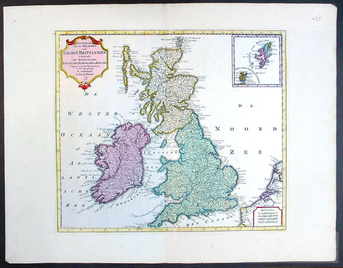
1750 Isaac Tirion Large Antique Map of Great Britain & Ireland
- Title : Nieuwe Kaaart van de Eilanden Groot Britannie behelsende Het Koningryk Engeland
- Ref #: 70087
- Size: 21 1/2in x 17in (545mm x 435mm)
- Date : 1750
- Condition: (A+) Fine Condition
Description:
This beautifully hand coloured original antique map of Great Britain & Ireland was published by Isaac Tirion in 1750.
Isaac Tirion was a successful publisher in Amsterdam during the 18th century who produced extensive volumes of Dutch town plans as well as a number of atlases with maps usually based on those of G. Delisle. His world atlases were finely engraved and beautifully colored as with this map for auction. (Ref: Tooley; M&B)
General Description:
Paper thickness and quality: - Heavy and stable
Paper color: - off white
Age of map color: - Original
Colors used: - Green, pink, yellow
General color appearance: - Authentic
Paper size: - 21 1/2in x 17in (545mm x 435mm)
Plate size: - 14 1/2in x 13in (370mm x 330mm)
Margins: - Min 1in (25mm)
Imperfections:
Margins: - None
Plate area: - None
Verso: - None
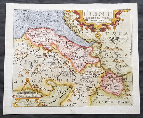
1610 Johannes Kip Antique Map of the County of Flintshire, Wales, Great Britain
- Title : Flint Comitatus quem Ordovices olim Incolucrunt
- Ref #: 01-3604
- Size: 15in x 13in (380mm x 330mm)
- Date : 1610
- Condition: (A+) Fine Condition
Description:
A very attractive early original hand coloured antique map of Flintshire (Welsh: Sir y Fflint) Wales, based on the first survey of the county by Christopher Saxton, was engraved by William Kip for William Camden's Britannia* (London: 1607-1637).
As well as still being the earliest printed map of Flintshire at an 'affordable' price it is also the first detailed one dedicted solely to the county.
General Definitions:
Paper thickness and quality: - Heavy and stable
Paper color : - off white
Age of map color: - Early
Colors used: - Blue, yellow, green, brown
General color appearance: - Authentic
Paper size: - 15in x 13in (380mm x 330mm)
Plate size: - 13in x 11in (330mm x 280mm)
Margins: - Min 1in (25mm)
Imperfections:
Margins: - Light soiling to margin edges
Plate area: - None
Verso: - None
Background:
Britannia', was one of the most popular and influential books of the period. The work of the Elizabethan antiquarian, William Camden (1551-1623), it was a detailed historical and topographical description of Great Britain. Its patriotic sentiments, in particular, both appealed to and generated the growing sense of nationalism that was coursing through late Tudor / early Stuart society. Between 1607 and 1637, county maps engraved by William Kip and William Hole, and based largely on Saxton's surveys, were added. These maps have the distinction of being the first set to show each county individually as opposed to several being grouped together on one page. Camden's Britannia continued to be published well into the 19th century; from 1695 to 1772, county maps by Robert Morden were used, and from 1789 to c.1815, those by the renowned John Cary.
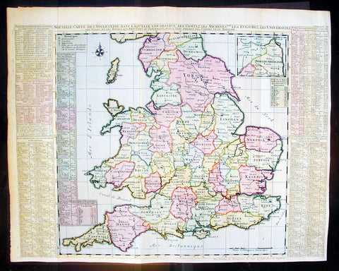
1720 Chatelain Antique Map of England & Wales
- Title : Nouvelle Carte De L Angleterre Dans Laquelle Lon Observe Lez Comtez Les Archives
- Ref #: 16370
- Size: 25 1/2in x 20 1/2in (650m x 430m)
- Date : 1720
- Condition: (A+) Fine Condition
Description:
This large fine beautifully hand coloured original antique map of England & Wales - with side text on all the different counties - by Henri Abraham Chatelain in 1720 was published in his famous Atlas Historique.
This is a magnificent map with bright hand colouring, clean strong sturdy paper and a heavy clear impression.
The Atlas Historique published by Henri Chatelain was part of a major work of its time, an encyclopedia in seven volumes, including geography as one of its main subjects. The text was by Nicholas Gueudeville and the maps by Chatelain. The Atlas included one of the finest map of America (four sheets) surrounded by vignettes and decorative insets. The Atlas Historique was completed between 1705 and 1720, further issues were published up to 1739. The series was published in Amsterdam, with Chatelain’s maps based on those of G. Delisle. (Ref: M&B; Tooley)
General Description:
Paper thickness and quality: - Heavy and stable
Paper color: - White
Age of map color: - Early
Colors used: - Pink, green, yellow, blue
General color appearance: - Authentic
Paper size: - 25 1/2in x 20 1/2in (650m x 430m)
Plate size: - 25in x 19 1/2in (635m x 495mm)
Margins: - min. 1/2in (10mm)
Imperfections:
Margins: - None
Plate area: - Folds as issued
Verso: - None
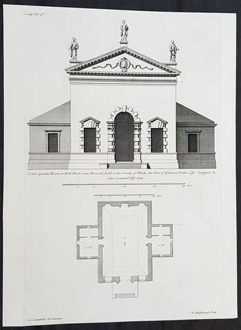
1724 Colen Campbell Antique Architect Print Garden Room Hall Barn, Downton Abbey
- Title : A new Garden Room at Hall Barn near Beaconsfield in the County of Bucks... Vol. 3, pl. 49.
- Ref #: 93462
- Size: 15in x 11 1/2in (380mm x 295mm)
- Date : 1724
- Condition: (A+) Fine Condition
Description:
This fine original copper-plate engraved of the Garden Room of Hall Barn in Beaconsfield, Buckinghamshire, England, designed by the famous Scottish architect and publisher Colen Campbell was engraved in 1724 - dated - by the Dutch engraver Henry Hulsbergh - and was published in the 1724 edition of Campbells monumental architectural publication Vitruvius Britannicus or The British Architect. London
Hall Barn was also the location used in the filming of the TV series Downton Abbey as the Loxley House.
General Definitions:
Paper thickness and quality: - Heavy and stable
Paper color : - off white
Age of map color: - Original
Colors used: - Yellow, green, blue, pink
General color appearance: - Authentic
Paper size: - 15in x 11 1/2in (380mm x 295mm)
Plate size: - 15in x 9 1/2in (380mm x 235mm)
Margins: - Min 1/2in (12mm)
Imperfections:
Margins: - None
Plate area: - None
Verso: - None
Background:
Hall Barn is a historic country house located in Beaconsfield, South Bucks district, in Buckinghamshire, England.
The Hall Barn estate was bought by Anne Waller in 1624. The house was built in the late-17th century by her son Edmund Waller, a poet and Member of Parliament at various times between 1624 and 1679. His grandson added the south wing. The estate was sold by his family in 1832 to Sir Gore Ouseley, 1st Baronet, who rebuilt the southern facade and was High Sheriff of Buckinghamshire for 1835.
Edward Levy-Lawson, 1st Baron Burnham bought the estate in 1880 and made a number of renovations and improvement and the estate remains under the management of the Lawson family - Hugh Lawson, 6th Baron Burnham - in the early 21st century.
There were royal visits to the estate, including from the Duke of Cambridge in November 1902. The Princess Royal took the salute at Hall Barn in the 1940s at the Girl Guide County Rally.
During the Second World War, the house was used as a hospital supplies unit. In November 1946, the Hall Barn Estate was reported in Tatler as being the lovely home and venue for the wedding reception for extended family and friends of the newly-wed daughter of the charming Lord and Lady Burnham.
Hall Barn has been used as a filming location for various films and series. In Gosford Park (2001) the opening sequence outside Lady Trenthams home was shot there, and the temple used as the scene for lunch after the shoot. Midsomer Murders Season 7, Episode 4 (2004) Sins of Commission, prominently features the black gatehouse to Hall Barn. It featured in the series Downton Abbey as Loxley House, the home of Sir Anthony Strallan. The location was also used in the 1981 Oscar-winning film Chariots of Fire as the home of the composite character Lord Andrew Lindsay, who memorably practiced his hurdling skills on the lawn by perching filled champagne glasses on each hurdle to determine if hed touched the hurdles or not on each jump. Hall Barn was also featured in the mini-series Sense and Sensibility (2008 miniseries), and used as the location for Delaford House. Black Beauty Film (1994)
Vitruvius Britannicus or The British Architect is from one of the finest works on architecture ever produced. Colen Campbell published the work in London in 1725. The engravings from this work feature illustrations, plans, and cross sections of English country houses and parks.
Campbell was the chief architect to the Prince of Wales. His work served as a design book that led to the construction of many of Britain’s great houses. Vitruvius Britannicus established Palladian architecture as the dominant style England in the 18th century.
Vitruvius Britannicus documented the buildings of some of the greatest architects of the times including Indigo Jones, Sir Christopher Wren, and Colen Campbell himself. The work is essential to the study of 17th and 18th century design and architecture in England.
Campbell, Colen 1676 - 1729
Campbell was a pioneering Scottish architect and architectural writer, credited as a founder of the Georgian style. For most of his career, he resided in Italy and England.
A descendant of the Campbells of Cawdor Castle, he is believed to be the Colinus Campbell who graduated from the University of Edinburgh in July 1695. He initially trained as a lawyer, being admitted to the Faculty of Advocates on 29 July 1702.
He had travelled in Italy from 1695–1702 and is believed to be the Colinus Campbell who signed the visitors book at the University of Padua in 1697. He is believed to have trained in and studied architecture under James Smith, this belief is strengthened by Campbell owning several drawings of buildings designed by Smith.
His major published work, Vitruvius Britannicus, or the British Architect... appeared in three volumes between 1715 and 1725. (Further volumes using the successful title were assembled by Woolfe and Gandon, and published in 1767 and 1771, see below.) Vitruvius Britannicus was the first architectural work to originate in England since John Shutes Elizabethan First Groundes. In the empirical vein, it was not a treatise but basically a catalogue of design, containing engravings of English buildings by Inigo Jones and Sir Christopher Wren, as well as Campbell himself and other prominent architects of the era.
In the introduction that he appended and in the brief descriptions, Campbell belaboured the excesses of Baroque style and declared British independence from foreigners while he dedicated the volume to Hanoverian George I. The third volume (1725) has several grand layouts of gardens and parks, with straight allées, for courts and patterned parterres and radiating rides through wooded plantations, in a Baroque manner that was rapidly becoming old-fashioned.
Buildings were shown in plan, section and elevation, but also some were in a birds-eye perspective. The drawings and designs contained in the book were under way before Campbell was drawn into the speculative scheme. The success of the volumes was instrumental in popularising neo-Palladian Architecture in Great Britain and America during the 18th century. For example, Plate 16 of Vitruvius Britannicus, a rendering of Somerset House in London, was an inspiration for American architect Peter Harrison when he designed the Brick Market in Newport, Rhode Island, in 1761.
Campbell was influenced as a young man by James Smith (ca 1645 – 1731), the pre-eminent Scots architect of his day, and an early neo-Palladian whom Campbell called the most experienced architect of Scotland (Vitruvius Britannicus, ii).
The somewhat promotional volume, with its excellently rendered engravings, came at a propitious moment at the beginning of a boom in country house and villa building among the Whig oligarchy. Campbell was quickly taken up by Lord Burlington, who replaced James Gibbs with Campbell at Burlington House in London and set out to place himself at the center of English neo-Palladian architecture. In 1718, Campbell was appointed deputy to the amateur gentleman who had replaced Wren as Surveyor General of the Royal Board of Works, an appointment that Burlington is certain to have pressed, but a short-lived one. When Benson, the new Surveyor was turned out of office, Campbell went with him.
Later Volumes There are some later volumes also published under the name Vitruvius Brittanicus, but they are not connected to Colen Campbells work, issued between 1715-1725. In 1739 a volume was issued by Badeslade and Rocque, described as Volume 4. However, this had little in common with Campbell, comprising mainly topographical perspective views of houses (54 plates). Between 1765–1771, Woolfe and Gandon published their Volumes 4 & 5 (with 79 plus 75 plates). They discounted Badeslades volume, believing their work to be a more correct continuation of Campbell, hence numbering it as Volume 4. The plates are indeed mostly plans and elevations of buildings largely in the Palladian style, most dating from after 1750. The various Volumes are fully described in Harris.
- Wanstead House, Essex: ca 1713/4 – 20 (illustrated left) In the first volume of Vitruvius Britannicus the most influential designs were two alternatives for a palatial Wanstead House, Essex, for the merchant-banker Sir Richard Child, of which the second design was already under way when the volume was published. (Campbell claimed that Wanstead House had Great Britains first classical portico, but this accolade probably belongs to The Vyne, Hampshire.
- Burlington House, London 1717. Remodelled the front and provided an entrance gateway for Richard Boyle, 3rd Earl of Burlington (Remodelled in 1868 and the gateway demolished.
- Stourhead, Wiltshire, 1721–24, as a seat for the London-based banker Henry Hoare. Wings were added in the later 18th century, and Campbells portico was not executed (though to his design) until 1841. The famous landscape garden round a lake, somewhat apart from the house, was developed after Campbells death, by Henry Flitcroft.
- Pembroke House, Whitehall, London, for Henry Herbert, 9th Earl of Pembroke, 1723, a London house in a prominent location for the heir of Jones Wilton House. It was rebuilt in 1757 and demolished in 1913. Lord Herbert (as he then was) was inspired by it to design the similar Marble Hill at Twickenham for Henrietta Howard, Countess of Suffolk, the mistress of the future George II. (Marble Hill was a 5-bay palladian villa with central pediment, raised on a high basement, with clumped screens of trees and formal turfed terraces descending to the Thames, illustrated right, that manifest the earliest stages of the English landscape garden.
- Houghton Hall, Norfolk, begun 1722, for Sir Robert Walpole, the Whig prime minister. Here Campbell was replaced by Gibbs, who capped the end pavilions with octagonal domes, and by William Kent, who designed the interiors.
- Mereworth Castle, Kent 1722 – 25: Campbells most overtly palladian design, based on Villa La Rotonda, capped with a dome with no drum, through which 24 chimney flues pass to the lantern.
- Waverley Abbey House, Surrey ca 1723–25 for John Aislabie (largely altered)
Title page, Vitruvius Britannicus; or, The British architect, containing the plans, elevations, and sections of the regular buildings, both publick and private in Great Britain, with variety of new designs, written by Colen Campbell
Nos 76 and 78 Brook Street, London W1, 1725 – 26. No. 76, which survives, was Campbells own house, the designs for its interiors published in his Five Orders of architecture, (1729). It carries a blue plaque commemorating him.
Compton Place, Eastbourne, Sussex, 1726 onwards, south front and extensive internal rebuilding for Sir Spencer Compton
Plumptre House, Nottingham 1724 - 30. Remodelled for John Plumptre MP.
Shawfield Mansion, Glasgow (1712) demolished 1792
Wanstead House, Essex (1714–15) demolished 1822
Hedworth House, Chester-le-Street (1726)
Hotham House, Beverley (1716–17) demolished c.1766
Burlington House, London, south front, and west wing (1717) subsequently extended and several occasions
Burlington (Ten Acre Close) Estate, London, layout (1717–18)
Burlington House, Great Gate and Street Wall (1718)
Rolls House, Chancery Lane, London (1718), demolished 1895–96
Ebberston Lodge, Ebberston, Yorkshire, including cascade (1718)
34 Great Burlington Street, London (1718–19)
33 Great Burlington Street, London (1719–20)
32 Great Burlington Street, London (c.1720); this was Campbells own house
31 Great Burlington Street, London (1719–24) rebuilt
Burlington Girls Charity School, Boyle Street, London (1719–21)
Wimbledon Manor House, Surrey, for Sir Theodore Janssen (1720); completion uncertain
Newby Park, (now Baldersby Park), near Topcliffe, Yorkshire (1720–21)
Houghton Hall, Norfolk; one of several architects to work on the building (1721–22)
Stourhead, Wiltshire, the portico part of Campbells design was only added in 1840 (1721–24); interiors destroyed by fire 1902
Mereworth Castle, Kent (1722–23)
Pembroke Lodge, Whitehall, London; executed Henry Herbert, 9th Earl of Pembrokes design (c.1724), demolished 1756
Plumptre House, Nottingham (1724)
Hall Barn, Buckinghamshire, garden buildings: Great Room (only partially survives), Temple of Venus, Obelisk & Doric Pavilion (1724)
Waverley Manor, Surrey (c.1725), extended 1770, damaged by fire and rebuilt 1833
Greenwich Hospital, Greenwich, London; additions to Queen Mary block and Queen Anne block (1726–29)
Compton Place, Eastbourne, remodelled house (1726–29)
76 Brook Street, London, internal alterations (c.1726); became Campbells new home
Hackney House, Hackney, London (c.1727), demolished before 1842
Althorp, Northamptonshire, new stables, loggia gate (c.1729–33)
Studley Royal Park, Yorkshire, the stables (c.1729) built after his death by Roger Morris
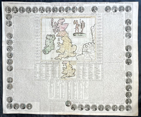
1719 Chatelain Antique Map Great Britain & Ireland Royalty Egbert to Queen Anne
- Title : Carte Pour L Introduction a L Historire S Angleteerre...
- Date : 1719
- Size: 25in x 21in (635mm x 535mm)
- Condition: (A+) Fine Condition
- Ref: 93426
Description:
This large beautifully hand coloured original antique map and illustration of Great Britain and Ireland, with text and pictorial representations of all the Kings and Queens from Egbert in 801 to Queen Anne in 1701, was published by Henri Abraham Chatelain in 1719, in his famous Atlas Historique.
General Definitions:
Paper thickness and quality: - Heavy and stable
Paper color : - off white
Age of map color: - Early
Colors used: - Yellow, pink, blue, green
General color appearance: - Authentic
Paper size: - 25in x 21in (635mm x 535mm)
Plate size: - 25in x 21in (635mm x 535mm)
Margins: - Min 1/4in (6mm)
Imperfections:
Margins: - Top left margin extended
Plate area: - None
Verso: - None
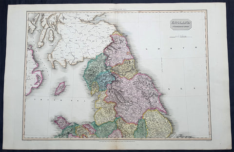
1811 John Pinkerton Very Large Antique Map of The North of England - Beautiful
- Title : England Northern Part....Published March 25th 1811 by Cadell & Davies
- Ref #: 93422
- Size: 33 1/2in x 22 1/2in (850mm x 570mm)
- Date : 1811
- Condition: (A+) Fine Condition
Description:
This large & magnificent, beautifully hand coloured original copper-plate engraved antique map of Northern England by John Pinkerton was engraved by Samuel Neele in 1811 - dated at the foot of the map - and published in the large elephant folio Pinkertons Modern Atlas, published between 1809 & 14. (Ref: Tooley, M&B)
General Definitions:
Paper thickness and quality: - Heavy and stable
Paper color : - off white
Age of map color: - Original
Colors used: - Yellow, green, blue, pink
General color appearance: - Authentic
Paper size: - 33 1/2in x 22 1/2in (850mm x 570mm)
Plate size: - 30 1/2in x 22 1/2in (775mm x 570mm)
Margins: - Min 2in (50mm)
Imperfections:
Margins: - None
Plate area: - None
Verso: - None
1852 ILN & J. Gilbert Large Antique Print of The Duke of Wellingtons Funeral Car
- Title : Wellingtons Funeral Car...J Gilbert....November 27 1852 - Supplement
- Size: 33in x 22in (840mm x 560mm)
- Condition: (A+) Fine Condition
- Date : 1852
- Ref #: 26373
Description:
This very large original wood-block engraved antique print of the Funeral Car of The Duke of Wellington by Sir John Gilbert, was published as a supplement to The Illustrated London News on the 27th of November 1852.
Sir John Gilbert RA 1817 – 1897 was an English artist, illustrator and engraver.
Gilbert was born in Blackheath, Surrey, and taught himself to paint. His only formal instruction was from George Lance. Skilled in several media, Gilbert gained the nickname, the Scott of painting. He was best known for the illustrations and woodcuts he produced for the Illustrated London News.
Gilbert was initially apprenticed to a firm of estate agents, but taught himself art by copying prints. He was unable to enter the Royal Academy Schools, but mastered watercolour, oils, and other media. From 1836 he exhibited at the Society of British Artists, and at the RA from 1838. The art patron Thomas Sheepshanks and the artist William Mulready suggested that he learn wood engraving. Starting with Punch, he moved on to the Illustrated London News. He produced an impressive number of wood-engravings for that publication and for The London Journal. He also produced very many illustrations for books, including nearly all the important English poets (including his illustrated Shakespeare with almost 750 drawings). He became president of the Royal Watercolour Society in 1871. He exhibited some 400 pictures in watercolour and oil exhibited at the various societies. In 1872 he was knighted. He became an RA in 1876, in the same year as Edward Poynter.
The Gilbert-Garret Competition for Sketching Clubs was started in 1870 at St. Martins School of Art, and named after its first president, John Gilbert.
Gilbert is buried at Brockley and Ladywell Cemeteries.
General Definitions:
Paper thickness and quality: - Heavy and stable
Paper color : - off white
Age of map color: -
Colors used: -
General color appearance: -
Paper size: - 33in x 22in (840mm x 560mm)
Plate size: - 33in x 22in (840mm x 560mm)
Margins: - Min 1/4in (5mm)
Imperfections:
Margins: - Re-joined along horizontal & vertical folds, no loss
Plate area: - Re-joined along horizontal & vertical folds, no loss
Verso: - Re-joined along horizontal & vertical folds, no loss
Background:
Arthur Wellesley, 1st Duke of Wellington, KG, GCB, GCH, PC, FRS 1769 – 1852) was an Anglo-Irish soldier and statesman who was one of the leading military and political figures of 19th-century Britain, serving twice as Prime Minister. His victory against Napoleon at the Battle of Waterloo in 1815 puts him in the first rank of Britain\'s military heroes.
Wellesley was born in Dublin, into the Protestant Ascendancy in Ireland. He was commissioned as an ensign in the British Army in 1787, serving in Ireland as aide-de-camp to two successive Lords Lieutenant of Ireland. He was also elected as a Member of Parliament in the Irish House of Commons. He was a colonel by 1796, and saw action in the Netherlands and in India, where he fought in the Fourth Anglo-Mysore War at the Battle of Seringapatam. He was appointed governor of Seringapatam and Mysore in 1799 and, as a newly appointed major-general (since 1802), won a decisive victory over the Maratha Confederacy at the Battle of Assaye in 1803.
Wellesley rose to prominence as a general during the Peninsular campaign of the Napoleonic Wars, and was promoted to the rank of field marshal after leading the allied forces to victory against the French Empire at the Battle of Vitoria in 1813. Following Napoleon\'s exile in 1814, he served as the ambassador to France and was granted a dukedom. During the Hundred Days in 1815, he commanded the allied army which, together with a Prussian army under Blücher, defeated Napoleon at Waterloo. Wellington\'s battle record is exemplary; he ultimately participated in some 60 battles during the course of his military career.
Wellington is famous for his adaptive defensive style of warfare, resulting in several victories against numerically superior forces while minimising his own losses. He is regarded as one of the greatest defensive commanders of all time, and many of his tactics and battle plans are still studied in military academies around the world.
After the end of his active military career, Wellington returned to politics. He was twice British prime minister as part of the Tory party: from 1828 to 1830, and for a little less than a month in 1834. He oversaw the passage of the Catholic Relief Act 1829, but opposed the Reform Act 1832. He continued as one of the leading figures in the House of Lords until his retirement and remained Commander-in-Chief of the British Army until his death.
Wellington died at Walmer Castle in Deal on 14 September 1852. This was his residence as Lord Warden of the Cinque Ports. Walmer Castle was said to have been his favourite residence. He was found to be unwell on that morning and was aided from his military campaign bed (the same one he used throughout his historic military career) and seated in his chair where he died. His death was recorded as being due to the after-effects of a stroke culminating in a series of seizures. He was aged 83.
Although in life he hated travelling by rail (after witnessing the death of William Huskisson, one of the first railway accident casualties), his body was then taken by train to London, where he was given a state funeral – one of only a handful of British subjects to be honoured in that way (other examples are Lord Nelson and Sir Winston Churchill) – and the last heraldic state funeral to be held in Britain. The funeral took place on 18 November 1852. At his funeral there was hardly any space to stand because of the number of people attending, and the effusive praise given him in Tennyson\'s Ode on the Death of the Duke of Wellington attests to his stature at the time of his death. He was buried in a sarcophagus of luxulyanite in St Pauls Cathedral next to Lord Nelson. A bronze memorial was sculpted by Alfred Stevens, and features two intricate supports: Truth tearing the tongue out of the mouth of False-hood, and Valour trampling Cowardice underfoot. Stevens did not live to see it placed in its home under one of the great arches of the Cathedral.
Wellington\'s casket was decorated with banners which were made for his funeral procession. Originally, there was one from Prussia, which was removed during World War I and never reinstated. In the procession, the Great Banner was carried by General Sir James Charles Chatterton of the 4th Dragoon Guards on the orders of Queen Victoria.
Most of the book A Biographical Sketch of the Military and Political Career of the Late Duke of Wellington by Weymouth newspaper proprietor Joseph Drew is a detailed contemporary account of his death, lying in state and funeral.
After his death, Irish and English newspapers disputed whether Wellington had been born an Irishman or an Englishman. In 2002, he was number 15 in the BBC\'s poll of the 100 Greatest Britons.
Owing to its links with Wellington, as the former commanding officer and colonel of the regiment, the title 33rd (The Duke of Wellington\'s) Regiment was granted to the 33rd Regiment of Foot, on 18 June 1853 (the 38th anniversary of the Battle of Waterloo) by Queen Victoria. Wellington\'s battle record is exemplary; he participated in some 60 battles during the course of his military career.
1760 Vue D Optic Large Antique Print View of Cheapside, London St Mary le Bow
- Title : Prospectus majoris viae, et Ecclesiae Sanctae Mariae in Londino; 25c Vue D Optique Representatnt; Le Grande Rue, et L Englise St Marie de Londres
- Ref : 43197
- Size: 18in x 13in (460mm x 330mm)
- Date : 1756
- Condition: (A) Very Good Condition
Description:
This hand coloured original antique print, a view of Cheapside and St Marys Le Bow, London was published as part of the Vues d’Optique in 1760.
St Mary-le-Bow is an historic church rebuilt after the Great Fire of 1666 by Sir Christopher Wren in the City of London on the main east–west thoroughfare, Cheapside. According to tradition a true Cockney must be born within earshot of the sound of Bow Bells (which refers to this church's bells rather than St Mary and Holy Trinity, Bow Road, in Bow, an outlying village until the 19th century.
Vues d'Optique or Perspective Views: Perspective views, or "vues d'optique," are a special type of popular print published in Europe during the 18th century. These prints provided a form of entertainment when viewed through a device called an "optical machine" or an "optique." The most characteristic feature of the perspective views is their emphasized linear perspective, done to further intensify the enhanced appearance of depth and illusionistic space in the prints when viewed through an optique. When displayed in the optique, the prints might transport the viewer into a far away place---an unknown city, or perhaps into the midst of a dramatic bit of contemporary history. Another attribute of these prints is their bright, often heavy hand coloring, applied boldly so as to show the tints when viewed through the lens.
A number of perspective prints depicted American scenes at the time of the Revolution for a European audience hungry for news of the events in the British colonies. As documents of American history and European printmaking, these are unusual and appealing eighteenth-century prints. (Ref: M&B; Tooley)
General Description:
Paper thickness and quality: - Heavy & stable
Paper color: - White
Age of map color: - Original
Colors used: - Blue, yellow, green, red
General color appearance: - Authentic & bright
Paper size: - 18in x 13in (460mm x 330mm)
Plate size: - 16 1/2in x 10in (420mm x 255mm)
Margins: - Min 1in (25mm)
Imperfections:
Margins: - Repair to top margin, no loss
Plate area: - None
Verso: - None
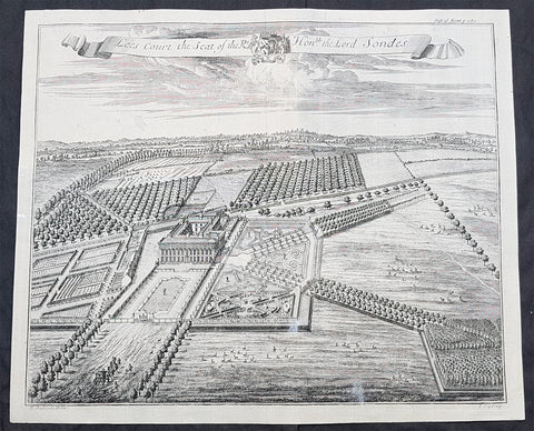
1719 J. Kip Antique View House & Garden of Lees Court, Lord Sondes Kent, England
- Title : Lees Court the Seat of the Rt Hon.ble the Lord Sondes
- Size: 17 1/2in x 15in (445mm x 365mm)
- Condition: (B) Good Condition
- Date : 1719
- Ref #: 93116
Description:
This original copper plate engraved antique print a view of Lees Court and surrounding gardens, home of the Sondes family since the mid 17th century, located in the Swale district in the county of Kent, England was published in the 1719 Johannes Kips publication Britannia Illustrata or Views of Several of the Queens Palaces also of the Principal Seats of the Nobility and Gentry of Great Britain
Lees Court was built in 1652 on the site of an earlier house, by Sir George Sondes whose family had bought the estate in 1600. The front of the house is said to have been after a design by Inigo Jones. Sir George was made Earl of Feversham shortly before his death in 1677, and was succeeded in the estate and title by his son-in-law, Louis, Lord Duras of Holdenby. By the early 18c the house had been surrounded by an extensive arrangement of formal gardens, presumably at the direction of Duras, and these are recorded in engravings by Kip and by Badeslade (both in Harris 1719). When Duras died in 1709, the Lees Court estate passed to his late wife\'s sister, Sir George Sondes\' younger daughter. She was married to Lewis Watson, Lord Rockingham, who was created Earl of Rockingham in 1714. On his grandson Thomas Watson, 3rd Earl of Rockingham\'s death in 1746 Lees Court was inherited by a cousin, Lewis Monson, who took the additional name of Watson and was later raised to the peerage as Baron Sondes. Towards the end of the C18 Sir John Soane was commissioned to build new stables, estate offices, and a dairy at a time when changes were underway in the park. In the first decade of the C20 the C17 house was badly damaged by a fire and the Sondes family employed the architects Edward Hoare and Montagu Wheeler to rebuild it. In 1908 Mrs Gerald Leigh, who had leased the estate from Lord Sondes, commissioned Thomas H Mawson (1861-1933), assisted by Robert Atkinson to lay out formal gardens beneath the south-east front. Although leased at times throughout its history, Lees Court remained in the ownership of the Sondes family until the mid 1970s
General Definitions:
Paper thickness and quality: - Heavy and stable
Paper color : - off white
Age of map color: -
Colors used: -
General color appearance: -
Paper size: - 17 1/2in x 15in (445mm x 365mm)
Plate size: - 17 1/2in x 15in (445mm x 365mm)
Margins: - Min 1/2in (12mm)
Imperfections:
Margins: - None
Plate area: - Print backed with contemporary paper on top left verso
Verso: - Repair as noted
Background:
Britannia Illustrata, also known as Views of Several of the Queens Palaces and also of the Principal Seats of the Nobility & Gentry of Great Britain is a 1707–09 map plate folio of parts of Great Britain, arguably the most important work of Dutch draughtsman Jan Kip, who collaborated with Leonard Knijff. The folio consisted of a range of large, detailed folded colored and black and white drawings which today provides a valuable insight into land and buildings at country estates at the time.
The volume is among the most important English topographical publications of the 18th century. Architecture is rendered with care, and the settings of parterres and radiating avenues driven through woods or planted across fields, garden paths gates and toolsheds are illustrated in detail, and staffed with figures and horses, coaches pulling into forecourts, water-craft on rivers, in line with the traditions of the Low Countries. Some of the plates are in the Siennese map perspective. At Althorp in Northamptonshire, the map revealed in detail the changes to the gardens by André Le Nôtre from earlier maps and depictions. Kip updated the plates in the 1720s.
1801 Gustaf Klint Large Map Sea Chart Celtic Sea Ireland to Bristol, Cornwall et
-
Title : Charta ofver Upgaende Grunden Jemte Opningarne Till Saint George, Bristols och Engelska Canalerne Gustaf af Klint Stockholm 1801
- Ref #: 35615
-
Condition: (A+) Fine Condition
- Size: 39 1/2in x 27in (990mm x 685mm)
- Date : 1801
Description:
This very large original copper plate engraved map a sea chart of The Celtic Sea, from southern Ireland to the Bristol Channel, Cornwall & The Scilly Islands was by the Swedish naval officer and cartographer Gustaf af Klint was engraved and published in 1801, dated.
General Definitions:
Paper thickness and quality: - Heavy and stable
Paper color : - off white
Age of map color: -
Colors used: -
General color appearance: -
Paper size: - 39 1/2in x 27in (990mm x 685mm)
Plate size: - 39 1/2in x 27in (990mm x 685mm)
Margins: - Min 1/2in (12mm)
Imperfections:
Margins: - None
Plate area: - None
Verso: - None
Background:
The Celtic Sea is an area of the Atlantic Ocean that stretches from the southern coast of Ireland to the western coast of Brittany in France. It is named after the Celtic culture that was once dominant in the region. The sea is bordered by several countries including Ireland, the United Kingdom, and France. It is a busy shipping route, with commercial vessels transporting goods between ports in Europe and North America. The sea is also important for fishing, with a variety of fish species, such as mackerel, herring, and cod, found in its waters. Additionally, the Celtic Sea is known for its rich marine biodiversity, with numerous species of dolphins, whales, and seabirds inhabiting the area.
Klint, Gustaf af 1774 - 1840
Gustaf af Klint was a Swedish naval officer born on September 14, 1772, in Örebro, Sweden. He began his naval career at the age of 16, joining the Swedish Navy in 1788. Over the years, he served in various positions and rose through the ranks, becoming a captain in 1801.
In addition to his naval career, Gustaf af Klint was also a skilled cartographer. He produced several detailed maps of the Swedish coast and Baltic Sea, which were widely used by sailors and navigators at the time. His maps were known for their accuracy and attention to detail, making them an essential tool for safe navigation in the often treacherous waters of the Baltic Sea.
One of Gustaf af Klint's most significant contributions to cartography was his work on the "Sea Atlas of the Baltic Sea," which he began in 1806. The atlas contained detailed maps of the entire Baltic Sea region, including the coasts of Sweden, Finland, Russia, Estonia, Latvia, and Lithuania. The maps were meticulously drawn, with precise soundings, navigational hazards, and coastal features clearly marked.
Gustaf af Klint retired from the Swedish Navy in 1824, having reached the rank of Rear Admiral. He continued to work on his sea atlas until his death in 1840, leaving behind a lasting legacy as one of Sweden's most accomplished naval officers and cartographers. Today, his maps are considered a valuable historical record of the Baltic Sea region and are sought after by collectors and historians alike.
Please note all items auctioned are genuine, we do not sell reproductions. A Certificate of Authenticity (COA) can be issued on request.
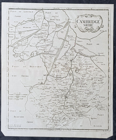
1722 Robert Morden Antique Map of the English County of Cambridgeshire
- Title : Cambridgeshire...Sold by Abel Swal and Awsham& John Churchill Sutton Nicholls sculp.
- Size: 16 1/4in x 15in (460mm x 380mm)
- Condition: (A+) Fine Condition
- Date : 1722
- Ref #: 40181
Description:
This fine original copper-plate engraved antique map of the English county of Cambridgeshire by Robert Morden was published in the 1722 edition of Camdens Britannia.
General Definitions:
Paper thickness and quality: - Heavy and stable
Paper color : - off white
Age of map color: -
Colors used: -
General color appearance: -
Paper size: - 16 1/4in x 15in (460mm x 380mm)
Plate size: - 15 1/2in x 14 1/2in (450mm x 370mm)
Margins: - Min 1/2in (12mm)
Imperfections:
Margins: - None
Plate area: - None
Verso: - None
Background:
William Camden 1551 – 1623 was an English antiquarian, historian, topographer, and herald, best known as author of Britannia, the first chorographical survey of the islands of Great Britain and Ireland, and the Annales, the first detailed historical account of the reign of Elizabeth I of England.
In 1577, with the encouragement of Abraham Ortelius, Camden began his great work Britannia, a topographical and historical survey of all of Great Britain and Ireland. His stated intention was to restore antiquity to Britaine, and Britain to his antiquity. The first edition, written in Latin, was published in 1586. It proved very popular, and ran through five further editions, of 1587, 1590, 1594, 1600 and 1607, each greatly enlarged from its predecessor in both textual content and illustrations. The 1607 edition included for the first time a full set of English county maps, based on the surveys of Christopher Saxton and John Norden, and engraved by William Kip and William Hole (who also engraved the fine frontispiece). The first English language edition, translated by Philemon Holland, appeared in 1610, again with some additional content supplied by Camden.
Britannia is a county-by-county description of Great Britain and Ireland. It is a work of chorography: a study that relates landscape, geography, antiquarianism, and history. Rather than write a history, Camden wanted to describe in detail the Great Britain of the present, and to show how the traces of the past could be discerned in the existing landscape. By this method, he produced the first coherent picture of Roman Britain.
He continued to collect materials and to revise and expand Britannia throughout his life. He drew on the published and unpublished work of John Leland and William Lambarde, among others, and received the assistance of a large network of correspondents with similar interests. He also travelled throughout Great Britain to view documents, sites, and artefacts for himself: he is known to have visited East Anglia in 1578, Yorkshire and Lancashire in 1582, Devon in 1589, Wales in 1590, Salisbury, Wells and Oxford in 1596, and Carlisle and Hadrians Wall in 1599. His fieldwork and firsthand research set new standards for the time. He even learned Welsh and Old English for the task: his tutor in Old English was Laurence Nowell.
In 1593 Camden became headmaster of Westminster School. He held the post for four years, but left when he was appointed Clarenceux King of Arms. By this time, largely because of the Britannias reputation, he was a well-known and revered figure, and the appointment was meant to free him from the labour of teaching and to facilitate his research. The College of Arms at that time was not only a centre of genealogical and heraldic study, but also a centre of antiquarian study. The appointment, however, roused the jealousy of Ralph Brooke, York Herald, who, in retaliation, published an attack on Britannia, charging Camden with inaccuracy and plagiarism. Camden successfully defended himself against the charges in subsequent editions of the work.
Britannia was recognised as an important work of Renaissance scholarship, not only in England, but across the European Republic of Letters. Camden considered having the 1586 Britannia printed in the Low Countries, and although that did not happen, the third edition of 1590, in addition to its London printing, was also published the same year in Frankfurt, and reprinted there in 1616. In 1612 parts were condemned by the Spanish Inquisition. An abridgement was published in Amsterdam in 1617 and reprinted in 1639; and versions of the text were also included in Joan Blaeus Theatrum Orbis Terrarum (published in Amsterdam in 1645) and in Jan Janssoniuss Novus Atlas (again published in Amsterdam, in 1646)
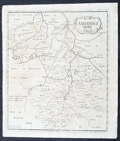
1722 Robert Morden Antique Map of Huntington in County of Cambridgeshire England
- Title : Huntington Shire by Robt. Morden...Sold by Abel Swale Awsham & John Churchill
- Size: 17 1/4in x 14 1/2in (435mm x 370mm)
- Condition: (A+) Fine Condition
- Date : 1722
- Ref #: 50149
Description:
This fine original copper-plate engraved antique map of the English region of Huntingdonshire, in the county of Cambridgeshire by Robert Morden was published in the 1722 edition of Camdens Britannia.
General Definitions:
Paper thickness and quality: - Heavy and stable
Paper color : - off white
Age of map color: -
Colors used: -
General color appearance: -
Paper size: - 17 1/4in x 14 1/2in (435mm x 370mm)
Plate size: - 17 1/4in x 14 1/2in (435mm x 370mm)
Margins: - Min 1/2in (6mm)
Imperfections:
Margins: - Light age toning
Plate area: - Light age toning
Verso: - Light age toning
Background:
William Camden 1551 – 1623 was an English antiquarian, historian, topographer, and herald, best known as author of Britannia, the first chorographical survey of the islands of Great Britain and Ireland, and the Annales, the first detailed historical account of the reign of Elizabeth I of England.
In 1577, with the encouragement of Abraham Ortelius, Camden began his great work Britannia, a topographical and historical survey of all of Great Britain and Ireland. His stated intention was to restore antiquity to Britaine, and Britain to his antiquity. The first edition, written in Latin, was published in 1586. It proved very popular, and ran through five further editions, of 1587, 1590, 1594, 1600 and 1607, each greatly enlarged from its predecessor in both textual content and illustrations. The 1607 edition included for the first time a full set of English county maps, based on the surveys of Christopher Saxton and John Norden, and engraved by William Kip and William Hole (who also engraved the fine frontispiece). The first English language edition, translated by Philemon Holland, appeared in 1610, again with some additional content supplied by Camden.
Britannia is a county-by-county description of Great Britain and Ireland. It is a work of chorography: a study that relates landscape, geography, antiquarianism, and history. Rather than write a history, Camden wanted to describe in detail the Great Britain of the present, and to show how the traces of the past could be discerned in the existing landscape. By this method, he produced the first coherent picture of Roman Britain.
He continued to collect materials and to revise and expand Britannia throughout his life. He drew on the published and unpublished work of John Leland and William Lambarde, among others, and received the assistance of a large network of correspondents with similar interests. He also travelled throughout Great Britain to view documents, sites, and artefacts for himself: he is known to have visited East Anglia in 1578, Yorkshire and Lancashire in 1582, Devon in 1589, Wales in 1590, Salisbury, Wells and Oxford in 1596, and Carlisle and Hadrians Wall in 1599. His fieldwork and firsthand research set new standards for the time. He even learned Welsh and Old English for the task: his tutor in Old English was Laurence Nowell.
In 1593 Camden became headmaster of Westminster School. He held the post for four years, but left when he was appointed Clarenceux King of Arms. By this time, largely because of the Britannias reputation, he was a well-known and revered figure, and the appointment was meant to free him from the labour of teaching and to facilitate his research. The College of Arms at that time was not only a centre of genealogical and heraldic study, but also a centre of antiquarian study. The appointment, however, roused the jealousy of Ralph Brooke, York Herald, who, in retaliation, published an attack on Britannia, charging Camden with inaccuracy and plagiarism. Camden successfully defended himself against the charges in subsequent editions of the work.
Britannia was recognised as an important work of Renaissance scholarship, not only in England, but across the European Republic of Letters. Camden considered having the 1586 Britannia printed in the Low Countries, and although that did not happen, the third edition of 1590, in addition to its London printing, was also published the same year in Frankfurt, and reprinted there in 1616. In 1612 parts were condemned by the Spanish Inquisition. An abridgement was published in Amsterdam in 1617 and reprinted in 1639; and versions of the text were also included in Joan Blaeus Theatrum Orbis Terrarum (published in Amsterdam in 1645) and in Jan Janssoniuss Novus Atlas (again published in Amsterdam, in 1646)
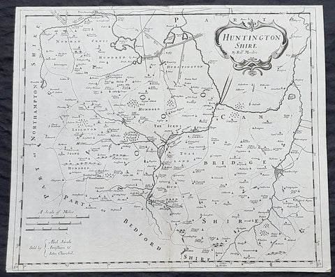
1722 Robert Morden Antique Map of Huntington in County of Cambridgeshire England
- Title : Huntington Shire by Robt. Morden...Sold by Abel Swale Awsham & John Churchill
- Size: 17 1/4in x 14 1/2in (435mm x 370mm)
- Condition: (A+) Fine Condition
- Date : 1722
- Ref #: 92680
Description:
This fine original copper-plate engraved antique map of the English region of Huntingdonshire, in the county of Cambridgeshire by Robert Morden was published in the 1722 edition of Camdens Britannia.
General Definitions:
Paper thickness and quality: - Heavy and stable
Paper color : - off white
Age of map color: -
Colors used: -
General color appearance: -
Paper size: - 17 1/4in x 14 1/2in (435mm x 370mm)
Plate size: - 17 1/4in x 14 1/2in (435mm x 370mm)
Margins: - Min 1/2in (6mm)
Imperfections:
Margins: - None
Plate area: - None
Verso: - None
Background:
William Camden 1551 – 1623 was an English antiquarian, historian, topographer, and herald, best known as author of Britannia, the first chorographical survey of the islands of Great Britain and Ireland, and the Annales, the first detailed historical account of the reign of Elizabeth I of England.
In 1577, with the encouragement of Abraham Ortelius, Camden began his great work Britannia, a topographical and historical survey of all of Great Britain and Ireland. His stated intention was to restore antiquity to Britaine, and Britain to his antiquity. The first edition, written in Latin, was published in 1586. It proved very popular, and ran through five further editions, of 1587, 1590, 1594, 1600 and 1607, each greatly enlarged from its predecessor in both textual content and illustrations. The 1607 edition included for the first time a full set of English county maps, based on the surveys of Christopher Saxton and John Norden, and engraved by William Kip and William Hole (who also engraved the fine frontispiece). The first English language edition, translated by Philemon Holland, appeared in 1610, again with some additional content supplied by Camden.
Britannia is a county-by-county description of Great Britain and Ireland. It is a work of chorography: a study that relates landscape, geography, antiquarianism, and history. Rather than write a history, Camden wanted to describe in detail the Great Britain of the present, and to show how the traces of the past could be discerned in the existing landscape. By this method, he produced the first coherent picture of Roman Britain.
He continued to collect materials and to revise and expand Britannia throughout his life. He drew on the published and unpublished work of John Leland and William Lambarde, among others, and received the assistance of a large network of correspondents with similar interests. He also travelled throughout Great Britain to view documents, sites, and artefacts for himself: he is known to have visited East Anglia in 1578, Yorkshire and Lancashire in 1582, Devon in 1589, Wales in 1590, Salisbury, Wells and Oxford in 1596, and Carlisle and Hadrians Wall in 1599. His fieldwork and firsthand research set new standards for the time. He even learned Welsh and Old English for the task: his tutor in Old English was Laurence Nowell.
In 1593 Camden became headmaster of Westminster School. He held the post for four years, but left when he was appointed Clarenceux King of Arms. By this time, largely because of the Britannias reputation, he was a well-known and revered figure, and the appointment was meant to free him from the labour of teaching and to facilitate his research. The College of Arms at that time was not only a centre of genealogical and heraldic study, but also a centre of antiquarian study. The appointment, however, roused the jealousy of Ralph Brooke, York Herald, who, in retaliation, published an attack on Britannia, charging Camden with inaccuracy and plagiarism. Camden successfully defended himself against the charges in subsequent editions of the work.
Britannia was recognised as an important work of Renaissance scholarship, not only in England, but across the European Republic of Letters. Camden considered having the 1586 Britannia printed in the Low Countries, and although that did not happen, the third edition of 1590, in addition to its London printing, was also published the same year in Frankfurt, and reprinted there in 1616. In 1612 parts were condemned by the Spanish Inquisition. An abridgement was published in Amsterdam in 1617 and reprinted in 1639; and versions of the text were also included in Joan Blaeus Theatrum Orbis Terrarum (published in Amsterdam in 1645) and in Jan Janssoniuss Novus Atlas (again published in Amsterdam, in 1646)
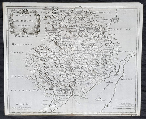
1722 Robert Morden Antique Map of the Welsh County of Monmouth
- Title : The county of Monmouth by Robt. Morden...Sold by Abel Swale Awsham & John Churchill
- Size: 17 1/4in x 14 1/2in (435mm x 370mm)
- Condition: (A+) Fine Condition
- Date : 1722
- Ref #: 70317
Description:
This fine original copper-plate engraved antique map of the Welsh county of Monmouth by Robert Morden was published in the 1722 edition of Camdens Britannia.
General Definitions:
Paper thickness and quality: - Heavy and stable
Paper color : - off white
Age of map color: -
Colors used: -
General color appearance: -
Paper size: - 17 1/4in x 14 1/2in (435mm x 370mm)
Plate size: - 17 1/4in x 14 1/2in (435mm x 370mm)
Margins: - Min 1/2in (6mm)
Imperfections:
Margins: - None
Plate area: - None
Verso: - None
Background:
William Camden 1551 – 1623 was an English antiquarian, historian, topographer, and herald, best known as author of Britannia, the first chorographical survey of the islands of Great Britain and Ireland, and the Annales, the first detailed historical account of the reign of Elizabeth I of England.
In 1577, with the encouragement of Abraham Ortelius, Camden began his great work Britannia, a topographical and historical survey of all of Great Britain and Ireland. His stated intention was to restore antiquity to Britaine, and Britain to his antiquity. The first edition, written in Latin, was published in 1586. It proved very popular, and ran through five further editions, of 1587, 1590, 1594, 1600 and 1607, each greatly enlarged from its predecessor in both textual content and illustrations. The 1607 edition included for the first time a full set of English county maps, based on the surveys of Christopher Saxton and John Norden, and engraved by William Kip and William Hole (who also engraved the fine frontispiece). The first English language edition, translated by Philemon Holland, appeared in 1610, again with some additional content supplied by Camden.
Britannia is a county-by-county description of Great Britain and Ireland. It is a work of chorography: a study that relates landscape, geography, antiquarianism, and history. Rather than write a history, Camden wanted to describe in detail the Great Britain of the present, and to show how the traces of the past could be discerned in the existing landscape. By this method, he produced the first coherent picture of Roman Britain.
He continued to collect materials and to revise and expand Britannia throughout his life. He drew on the published and unpublished work of John Leland and William Lambarde, among others, and received the assistance of a large network of correspondents with similar interests. He also travelled throughout Great Britain to view documents, sites, and artefacts for himself: he is known to have visited East Anglia in 1578, Yorkshire and Lancashire in 1582, Devon in 1589, Wales in 1590, Salisbury, Wells and Oxford in 1596, and Carlisle and Hadrians Wall in 1599. His fieldwork and firsthand research set new standards for the time. He even learned Welsh and Old English for the task: his tutor in Old English was Laurence Nowell.
In 1593 Camden became headmaster of Westminster School. He held the post for four years, but left when he was appointed Clarenceux King of Arms. By this time, largely because of the Britannias reputation, he was a well-known and revered figure, and the appointment was meant to free him from the labour of teaching and to facilitate his research. The College of Arms at that time was not only a centre of genealogical and heraldic study, but also a centre of antiquarian study. The appointment, however, roused the jealousy of Ralph Brooke, York Herald, who, in retaliation, published an attack on Britannia, charging Camden with inaccuracy and plagiarism. Camden successfully defended himself against the charges in subsequent editions of the work.
Britannia was recognised as an important work of Renaissance scholarship, not only in England, but across the European Republic of Letters. Camden considered having the 1586 Britannia printed in the Low Countries, and although that did not happen, the third edition of 1590, in addition to its London printing, was also published the same year in Frankfurt, and reprinted there in 1616. In 1612 parts were condemned by the Spanish Inquisition. An abridgement was published in Amsterdam in 1617 and reprinted in 1639; and versions of the text were also included in Joan Blaeus Theatrum Orbis Terrarum (published in Amsterdam in 1645) and in Jan Janssoniuss Novus Atlas (again published in Amsterdam, in 1646)
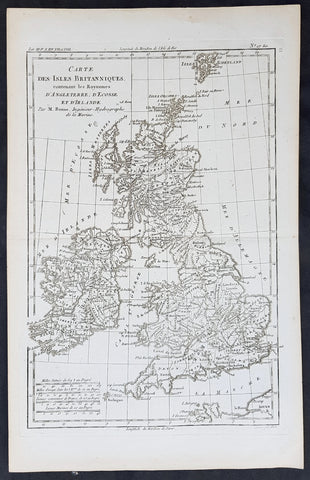
1780 Rigobert Bonne Original Antique Map of Great Britain and Ireland
- Title : Carte Des Isles Britanniques...M Bonne
- Size: 15in x 10in (380mm x 255mm)
- Ref #: 31667
- Date : 1780
- Condition: (A+) Fine Condition
Description:
This original copper-plate engraved map was published in 1780 edition of Atllas des toutes les parties connues du globe terrestre by Rigobert Bonne & Guillaume Raynal.
General Definitions:
Paper thickness and quality: - Heavy and stable
Paper color : - off white
Age of map color: -
Colors used: -
General color appearance: -
Paper size: - 15in x 10in (380mm x 255mm)
Plate size: - 13in x 9in (330mm x 230mm)
Margins: - Min 1in (25mm)
Imperfections:
Margins: - None
Plate area: - None
Verso: - None
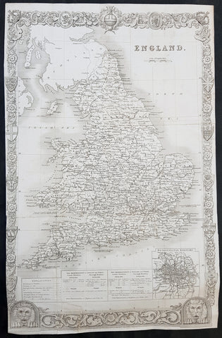
1836 Thomas Moule Large Original Antique Map of England & Wales
- Title : England
- Size: 17in x 11in (430mm x 280mm)
- Ref #: 31112
- Date : 1836
- Condition: (A) Very Good Condition
Description:
This original steel-plate engraved antique map of England was engraved for the 1836 edition of Thomas Moules English Counties Delineatedby W. Schmollinger.
Inset plan of Metorpolitan Boroughs of London.
General Definitions:
Paper thickness and quality: - Heavy and stable
Paper color : - off white
Age of map color: -
Colors used: -
General color appearance: -
Paper size: - 17in x 11in (430mm x 280mm)
Plate size: - 17in x 11in (430mm x 280mm)
Margins: - Min 0in (0mm)
Imperfections:
Margins: - Left margin cropped to border
Plate area: - Folds as issued, repair to bottom border & left bottom fold
Verso: - Re-enforced along folds
Background:
When considering the work of English map makers we tend, perhaps, to think too much in terms of county maps, dominated by the names of Saxton and Speed, but we should not underrate the contribution to the sum of geographical knowledge made in other spheres, such as the sea charts of Edward Wright, Robert Dudley and Greenvile Collins, the discoveries of James Cook, the road maps of Ogilby and Cary, the meteorological and magnetic charts compiled by Edmund Halley, to mention only a few.
In 1558 Queen Elizabeth came to the throne in the midst of a fast changing world. In 1563 a nineteen sheet map, copies of which survive only in manuscript form, was completed by Laurence Nowell, and no doubt, the issue of Mercator\'s large-scale map of the British Isles in 1564 had an important influence on the thought of the period. A few years later a national survey was commissioned privately, although probably at the instigation of Lord Burghley, the Lord Treasurer, but subsequently was completed with royal encouragement. The outcome was Christopher Saxton\'s Atlas of EngIand and Wales, started about 1570 and published in 1579 - the first printed set of county maps and the first countrywide atlas on such a splendid scale produced anywhere. A Welsh antiquarian, Humphrey Lhuyd completed a set of surveys that were even more successful than Saxton in which he had produced fine manuscript maps of England and Wales which were used by Ortelius in editions of his Atlas from 1573 onwards.
The earliest maps of the 17th century, attributed to William Smith of the College of Heralds, covered only twelve counties based on Saxton/Norden and were presumably intended to be part of a complete new atlas. They were printed in the Low Countries in 1602-3 and were soon followed by maps for the Latin edition of Camden\'s Britannia dated 1607. In 1610-11 the first edition of John Speed\'s famous county Atlas The Theatre of the Empire of Great Britaine was published and immediately replaced Saxton\'s in popular appeal. Although Speed assembled much of his material from the earlier works of Saxton, Norden and others, a considerable part of the up-to-date information, especially relating to the inset town plans depicted on his maps, was obtained first hand. The maps undoubtedly owed much of their popularity to the splendid engravings of high quality made in the workshops in Amsterdam of Jodocus Hondius to whom Speed sent his manuscripts, the plates subsequently being returned to London for printing.
In 1645, Volume IV of the famous Blaeu World Atlas covering the counties of England and Wales was published in Amsterdam. These maps have always been esteemed as superb examples of engraving and design, the calligraphy being particularly splendid, but nevertheless they were nearly all based on Saxton and Speed and added little to geographical knowledge.
Not until the latter part of the century do we find an English map maker of originality with the capacity to put new ideas into practice. John Ogilby, one of the more colourful figures associated with cartography, started life as a dancing master and finished as King\'s Cosmographer and Geographic Printer. After publishing a small number of county maps, somewhat on the lines of John Norden he issued in 1675 the Britannia, the first practical series of detailed maps of the post roads of England and Wales on a standard scale of 1,760 yards to the mile. Up to the end of the century and beyond, reprints and revisions of Saxton\'s and Speed\'s atlases continued to appear and the only other noteworthy county maps were Richard Blome\'s Britannia (1673), John Overton\'s Atlas (c. 1670) and Robert Morden\'s maps for an English translation of Camden\'s Britannia published in 1695.
Another noted cartographer of the day was Captain Greenvile Collins, and of his work in surveying the coasts of Great Britain culminating in the issue in 1693 of the Great Britain\'s Coasting Pilot. Apart from these charts, English cartographers published during the century a number of world atlases. Speed was the first Englishman to produce a world atlas with the issue in 1627 of his A Prospect of the Most Famous Parts of the World. Other atlases appeared later in the century by Peter Heylin, John Seller, William Berry, Moses Pitt and Richard Blome, whilst Ogilby found time to issue maps of Africa, America and Asia. Far more important, from the purely scientific point of view, was the work of Edmund Halley, Astronomer Royal, who compiled and issued meteorological and magnetic charts in 1688 and 1701 respectively.
At the beginning of the eighteenth century the Dutch map trade was finally in decline, the French in the ascendant and the English to a great extent still dominated by Saxton and Speed except, as we have shown, in the spheres of sea charts and road maps. There were atlases by John Senex, the Bowles family, Emanuel and Thomas Bowen, Thomas Badeslade and the unique bird\'s-eye perspective views of the counties, The British Monarchy by George Bickham. In 1750-60 Bowen and Kitchin\'s The Large English Atlas containing maps on a rather larger scale than hitherto was published.
In 1759 the Society for the encouragement of Arts, Manufactures and Commerce offered an award of £100 for the best original surveys on this scale and by the end of the century about thirty counties had been re-surveyed. These maps, many of which formed, in later years, the basis for the first issues of county maps by the Ordnance Survey Office were not only decorative but a tremendous improvement geographically on earlier local maps. As a consequence, the skills and expertise of the new-style cartographers soon enabled them to cover the world as well as the domestic market. Thomas Jefferys was such a man; he was responsible for a number of the new 1 in. to 1 mile county surveys and he issued an edition of Saxton\'s much battered 200-year-old plates of the county maps, but he is better known for many fine maps of North America and the West Indies. His work was continued on the same lines by William Faden, trading as Faden and Jefferys. Other publishers such as Sayer and Bennett and their successors Laurie and Whittle published a prodigious range of maps, charts and atlases in the second half of the century. A major influence at this time was John Cary who, apart from organizing the first re-survey of post roads since Ogilby and subsequently printing the noted Travellers\' Companion, was a prolific publisher of atlases and maps of every kind of all parts of the world. After starting work with Cary, and taking part in the new road survey, Aaron Arrowsmith set up in his own business and went on to issue splendid large-scale maps of many parts of the world. Both Cary\'s and Arrowsmith\'s plates were used by other publishers until far into the next century and, in turn, their work was taken up and developed by James Wyld (Elder and Younger) and Tallis and Co.
Later into the 19th century some of the better known cartographers and publishers were by Henry Teesdale (1829-30), Christopher and John Greenwood, surveyors, Thomas Moule, a writer on heraldry and antiques (1830-36) and John Walker (1837) but by about the middle of the century few small-scale publishers survived and their business passed into the hands of large commercial concerns such as Bartholomews of Edinburgh and Philips of London who continue to this day. (Ref: Shirley; Tooley; M&B)
1695 Rob. Morden Antique Map English County of Hereford
- Title : Hereford Shire by Rob. Morden
- Ref #: 40868
- Size: 17in x 15in (430mm x 380mm)
- Date : 1695
- Condition: (A+) Fine Condition
Description:
This attractive original antique map of the English county of Hereford, by Robert Morden, was published in the 1695 edition of Camden's Britannia.
William Camden was an historian who first published his Britannia, a description and history of Britain, in 1586. Written in Latin, the book contained only a general map of the country but had a wide circulation and eventually in 1607 an edition (the sixth) was published with a series of maps with Latin text on the reverse.
Further editions in English were published in 1610 and 1637 but without text. (Many more editions were published up until 1806 with map contributions from Blaeu in 1617, John Bill 1626, Robert Morden 1695-1772 and John Cary 1789-1806)
In the 1610 & 1617 editions the maps were mostly engraved by William Kip and William Hole and were based on those of Christopher Saxton, but six were copied from John Norden.
The map of Pembroke is by George Owen and the general maps of England/Wales, Scotland and Ireland were probably taken from Mercator. Kip reduced the size of each map for Britannia from the originals published byChristopher Saxton in 1579. (Ref: Tooley; M&B)
General Description:
Paper thickness and quality: - Light and stable
Paper color: - off white
Age of map color: - Early
Colors used: - Red, yellow, blue, green
General color appearance: - Authentic, heavy
Paper size: - 17in x 15in (430mm x 380mm)
Plate size: - 17in x 15in (430mm x 380mm)
Margins: - Min 1/4in (4mm)
Imperfections:
Margins: - Top margin cropped close to border
Plate area: - None
Verso: - None
1695 Morden Antique Map The Welsh County of Monmouth
- Title : The County of Monmouth by Robert. Morden
- Ref #: 40869
- Size: 17 1/2in x 15in (445mm x 380mm)
- Date : 1695
- Condition: (A+) Fine Condition
Description:
This fine beautifully hand coloured original antique map of the Welsh county of Monmouth was engraved by Robert Morden & published by Abel Swale & John Churchil for the 1695 edition of Willam Camden's Britannia.
William Camden was an historian who first published his Britannia, a description and history of Britain, in 1586. Written in Latin, the book contained only a general map of the country but had a wide circulation and eventually in 1607 an edition (the sixth) was published with a series of maps with Latin text on the reverse.
Further editions in English were published in 1610 and 1637 but without text. (Many more editions were published up until 1806 with map contributions from Blaeu in 1617, John Bill 1626, Robert Morden 1695-1772 and John Cary 1789-1806)
In the 1610 & 1617 editions the maps were mostly engraved by William Kip and William Hole and were based on those of Christopher Saxton, but six were copied from John Norden.
The map of Pembroke is by George Owen and the general maps of England/Wales, Scotland and Ireland were probably taken from Mercator. Kip reduced the size of each map for Britannia from the originals published by Christopher Saxton in 1579. (Ref: Tooley; M&B)
General Description:
Paper thickness and quality: - Light and stable
Paper color: - off white
Age of map color: - Early
Colors used: - Red, yellow, blue, green, blue
General color appearance: - Authentic
Paper size: - 17 1/2in x 15in (445mm x 380mm)
Plate size: - 16 1/2in x 14in (420mm x 355mm)
Margins: - Min 1/2in (12mm)
Imperfections:
Margins: - 4 small repairs to bottom margin
Plate area: - None
Verso: - None
1695 Morden Antique Map The Welsh County of Monmouth
- Title : The County of Monmouth by Robert. Morden
- Ref #: 50155
- Size: 17 1/2in x 15in (445mm x 380mm)
- Date : 1695
- Condition: (A+) Fine Condition
Description:
This fine beautifully hand coloured original antique map of the Welsh county of Monmouth was engraved by Robert Morden & published by Abel Swale & John Churchil for the 1695 edition of Willam Camden's Britannia.
William Camden was an historian who first published his Britannia, a description and history of Britain, in 1586. Written in Latin, the book contained only a general map of the country but had a wide circulation and eventually in 1607 an edition (the sixth) was published with a series of maps with Latin text on the reverse.
Further editions in English were published in 1610 and 1637 but without text. (Many more editions were published up until 1806 with map contributions from Blaeu in 1617, John Bill 1626, Robert Morden 1695-1772 and John Cary 1789-1806)
In the 1610 & 1617 editions the maps were mostly engraved by William Kip and William Hole and were based on those of Christopher Saxton, but six were copied from John Norden.
The map of Pembroke is by George Owen and the general maps of England/Wales, Scotland and Ireland were probably taken from Mercator. Kip reduced the size of each map for Britannia from the originals published by Christopher Saxton in 1579. (Ref: Tooley; M&B)
General Description:
Paper thickness and quality: - Light and stable
Paper color: - off white
Age of map color: - Early
Colors used: - Red, yellow, blue, green, blue
General color appearance: - Authentic
Paper size: - 17 1/2in x 15in (445mm x 380mm)
Plate size: - 16 1/2in x 14in (420mm x 355mm)
Margins: - Min 1/2in (12mm)
Imperfections:
Margins: - 4 small repairs to bottom margin
Plate area: - None
Verso: - None
1878 Edward Weller Large Antique Map of Wales
- Title : Wales by Edward Weller FRGS
- Size: 34 1/2in x 24 1/2in (880m x 620mm)
- Condition: (A) Very Good Condition
- Date : 1878
- Ref #: 70570
Description:
This very large original hand coloured steel plate engraved antique map of Wales by Edward Weller was published by Cassell, Petter & Galpin.
General Definitions:
Paper thickness and quality: - Heavy and stable
Paper color : - off white
Age of map color: - Original
Colors used: - Yellow, green, blue, pink
General color appearance: - Authentic
Paper size: - 34 1/2in x 24 1/2in (880m x 620mm)
Plate size: - 34 1/2in x 24 1/2in (880m x 620mm)
Margins: - Min 1/2in (12mm)
Imperfections:
Margins: - Light soiling
Plate area: - 13in repair to bottom left sheet, no loss
Verso: - Repair as noted
Background:
Cassell & Co is a British book publishing house, founded in 1848 by John Cassell (1817–1865), which became in the 1890s an international publishing group company.
John Cassell (1817–1865), who was in turn a carpenter, temperance preacher, tea and coffee merchant, finally turned to publishing. His first publication was on 1 July 1848, a weekly newspaper called The Standard of Freedomadvocating religious, political, and commercial freedom. The Working Man\\\\\\\'s Friend became another popular publication. In 1849 Cassell was dividing his time between his publishing and his grocery business. In 1851 his expanding interests led to his renting part of La Belle Sauvage, a London inn which had been a playhouse in Elizabethan times. The former inn was demolished in 1873 to make way for a railway viaduct, with the company building new premises behind. La Belle Sauvage was destroyed in 1941 by WWII bombing as well as many archives.
Thomas Dixon Galpin who came from Dorchester in Dorset and George William Petter who was born in Barnstaplein Devon were partners in a printing firm and on John Cassell\\\\\\\'s bankruptcy in June 1855 acquired the publishing company and Cassell\\\\\\\'s debts. Between 1855 and 1858 the printing firm operated as Petter and Galpin and their work was published by W. Kent & Co.
John Cassell was relegated to being a junior partner after becoming insolvent in 1858, the firm being known as Cassell, Petter & Galpin. With the arrival of a new partner, Robert Turner, in 1878, it became Cassell, Petter, Galpin & Company. Galpin was the astute business manager. George Lock, the founder of Ward Lock, another publishing house, was Galpin\\\\\\\'s first cousin. Petter resigned in 1883 as a result of disagreement over publishing fiction, and in 1888 the company name was changed to Cassell & Co, Ltd, following Galpin\\\\\\\'s retirement and Petters death.
Weller, Edward 1819 – 1884
Weller was a British engraver and cartographer who was one of the first to produce maps using lithography. He was a London-based working from offices in Red Lion Square and later, Bloomsbury.
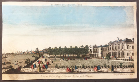
1760 Vue D Optic Large Antique Print View of Old Somerset House, Thames London
- Title : Vue du Palias Royal Somerset du cote de la Thamise
- Ref : 26261
- Size: 16in x 9 1/2in (405mm x 240mm)
- Date : 1756
- Condition: (B) Good Condition
Description:
This hand coloured original antique print, a view of the old Somerset House, prior to the late 18th century refurbishment, on the River Thames, London was published as part of the Vues d’Optique in 1760.
Somerset House is a large Neoclassical building situated on the south side of the Strand in central London, overlooking the River Thames, just east of Waterloo Bridge. The building, originally the site of a Tudor Palace was designed by Sir William Chambers in 1776, and further extended with Victorian wings to the east and west in 1831 and 1856 respectively. The East Wing forms part of the adjacent Strand campus of King's College London
Vues d'Optique or Perspective Views: Perspective views, or "vues d'optique," are a special type of popular print published in Europe during the 18th century. These prints provided a form of entertainment when viewed through a device called an "optical machine" or an "optique." The most characteristic feature of the perspective views is their emphasized linear perspective, done to further intensify the enhanced appearance of depth and illusionistic space in the prints when viewed through an optique. When displayed in the optique, the prints might transport the viewer into a far away place---an unknown city, or perhaps into the midst of a dramatic bit of contemporary history. Another attribute of these prints is their bright, often heavy hand coloring, applied boldly so as to show the tints when viewed through the lens.
A number of perspective prints depicted American scenes at the time of the Revolution for a European audience hungry for news of the events in the British colonies. As documents of American history and European printmaking, these are unusual and appealing eighteenth-century prints. (Ref: M&B; Tooley)
General Description:
Paper thickness and quality: - Heavy & stable
Paper color: - White
Age of map color: - Original
Colors used: - Blue, yellow, green, red
General color appearance: - Authentic & bright
Paper size: - 16in x 9 1/2in (405mm x 240mm)
Plate size: - 16in x 9 1/2in (405mm x 240mm)
Margins: - Min 0in (0mm)
Imperfections:
Margins: - Left margin cropped to image edge
Plate area: - Soiling and creasing the bottom left edge
Verso: - Soiling
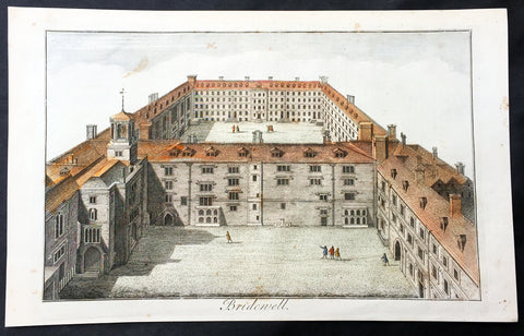
1756 Maitland Large Antique Print of Bridewell Palace, Prison London, England
- Title : Bridewell
- Ref : 26335
- Size: 15in x 9 1/2in (380mm x 245mm)
- Date : 1756
- Condition: (A+) Fine Condition
Description:
This fine hand coloured original antique print of Bridewell Palace as it was as a prison in the 18th century was engraved by Benjamin Cole and published in the 1756 edition of The History of London from its Foundation to the Present Time...', by William Maitland, Osborne & Shipton and Hodges, London.
Bridewell Palace in London was built as a residence of King Henry VIII and was one of his homes early in his reign for eight years. Given to the City of London Corporation by his son King Edward VI for use as an orphanage and place of correction for wayward women, Bridewell later became the first prison/poorhouse to have an appointed doctor.
It was built on the banks of the Fleet River in the City of London between Fleet Street and the River Thames in an area today known as 'Bridewell Court' off New Bridge Street. By 1556 part of it had become a jail known as Bridewell Prison. It was reinvented with lodgings and was closed in 1855 and the buildings demolished in 1863–1864. (Ref: Tooley; M&B)
General Description:
Paper thickness and quality: - Heavy and stable
Paper color: - off white
Age of map color: - Early
Colors used: - Red, yellow, green
General color appearance: - Authentic
Paper size: - 15in x 9 1/2in (380mm x 245mm)
Plate size: - 13 3/4in x 8 1/4in (350mm x 210mm)
Margins: - Min 1in (25mm)
Imperfections:
Margins: - None
Plate area: - None
Verso: - None
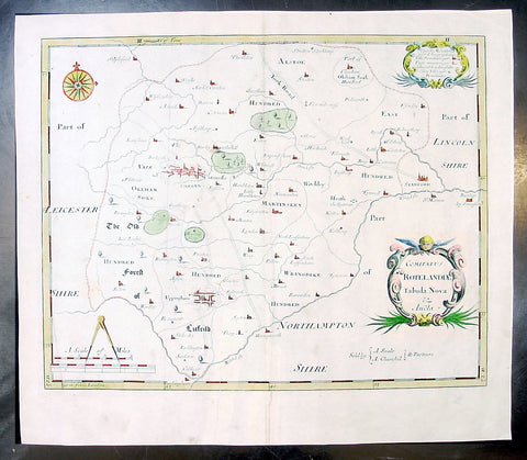
1695 Morden Antique Map The English County of Rutland
- Title : Comitatus Rotelandiae Tabula Nova & Aucta
- Ref #: 50145
- Size: 16in x 14in (405mm x 355mm)
- Date : 1695
- Condition: (A+) Fine Condition
Description:
This beautifully hand coloured original antique map of the English County of Rutland was engraved by Robert Morden for the 1695 edition of Camden's Britannia.
William Camden was an historian who first published his Britannia, a description and history of Britain, in 1586. Written in Latin, the book contained only a general map of the country but had a wide circulation and eventually in 1607 an edition (the sixth) was published with a series of maps with Latin text on the reverse.
Further editions in English were published in 1610 and 1637 but without text. (Many more editions were published up until 1806 with map contributions from Blaeu in 1617, John Bill 1626, Robert Morden 1695-1772 and John Cary 1789-1806)
In the 1610 & 1617 editions the maps were mostly engraved by William Kip and William Hole and were based on those of Christopher Saxton, but six were copied from John Norden.
The map of Pembroke is by George Owen and the general maps of England/Wales, Scotland and Ireland were probably taken from Mercator. Kip reduced the size of each map for Britannia from the originals published byChristopher Saxton in 1579. (Ref: Tooley; M&B)
General Description:
Paper thickness and quality: - Light and stable
Paper color: - off white
Age of map color: - Early
Colors used: - Red, yellow, blue, green, blue
General color appearance: - Authentic
Paper size: - 16in x 14in (405mm x 355mm)
Plate size: - 14 1/2in x 11 1/2in (370mm x 290mm)
Margins: - Min 1in (25m)
Imperfections:
Margins: - None
Plate area: - None
Verso: - None
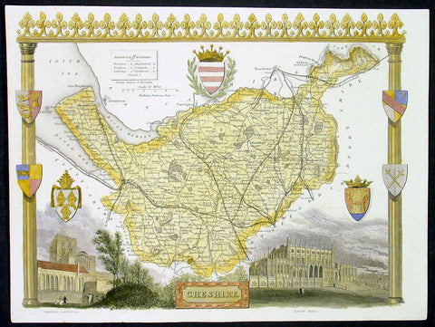
1836 Moule Antique Map The English County of Cheshire
- Title : Cheshire
- Date : 1836
- Condition: (A+) Fine Condition
- Ref: 92439
- Size: 11in x 8 1/2in (280mm x 215mm)
Description:
This finely engraved original beautifully hand coloured original antique map of the English county of Cheshire by Thomas Moule was published in the 1836 edition of Barclays Dictionary. Moules maps were some of the the last original decorative maps published in the 19th century. (Ref: Tooley; M&B)
General Description:
Paper thickness and quality: - Heavy and stable
Paper color: - off white
Age of map color: - Early
Colors used: - Yellow, green, red, blue
General color appearance: - Authentic
Paper size: - 11in x 8 1/2in (280mm x 215mm)
Plate size: - 11in x 8 1/2in (280mm x 215mm)
Margins: - Min 1/4in (6mm)
Imperfections:
Margins: - None
Plate area: - None
Verso: - None